

TRIP DETAILS
LENGTH 35 miles
DIFFICULTY rated difficult due to navigation, overgrown/detoured trails and remote nature. Requires previous experience.
DATE HIKED September 25-27, 2020
MAIN FEATURES The Sioux–Hustler Trail is a rugged hiking loop in the Boundary Waters Canoe Area in Northern Minnesota, near the Canadian border. This area is mostly known for its paddling trips, and traveling in the Fall was an optimal time to visit due to lack of bugs, cool weather and pristine views of the forest changing color. Hikers should be aware that most sites are also accessible by canoe and camp inhabitants are not required to share campsites (so, go mid week or get to camp early to get a spot!) The trail is muddy, rocky, re-routed by several beaver dams and does not include any navigational signing. Water is plentiful, as the trail circumvents the following lakes and rivers: Little Sioux, Lower Pauness, Loon, Pageant, Range Line, Hustler, Emerald, Shohola, Agawato, Heritage, Lynx, Little Shell and Shell Lake. Moose are common in the area, and if you listen closely, you may hear wolves or coyotes howling at night. Check out our Youtube video for more on campsite conditions and tales from the trail!
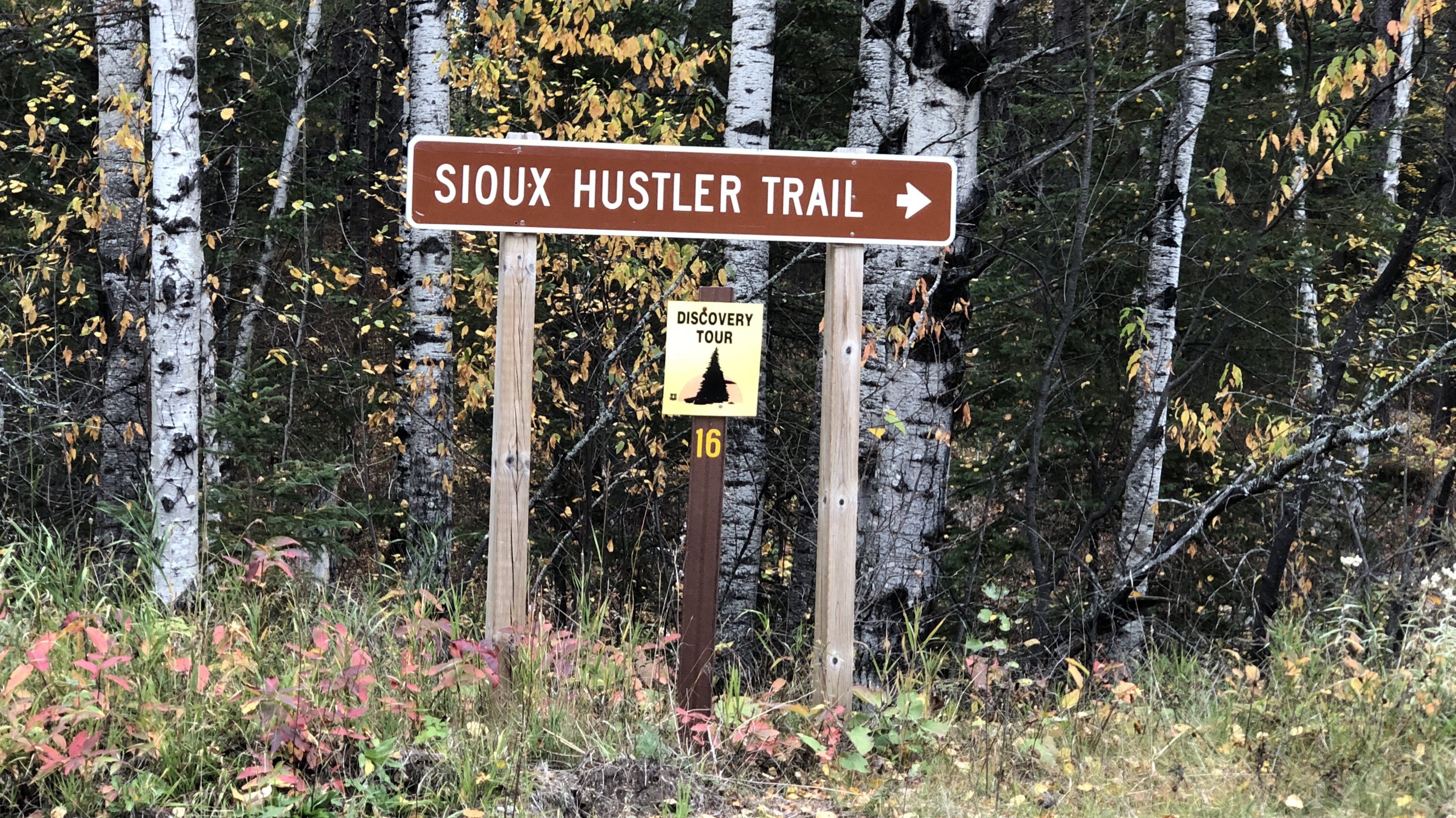
The Other SHT
This trail is on the traditional land of the Anishinabewaki ᐊᓂᔑᓈᐯᐗᑭ Očhéthi Šakówiŋ people. The trail gets it’s name from the Little Indian Sioux River and Hustler Lake, but rounds many other bodies of water. There are different views on whether the term Sioux should still be used today, and we found that most people unfamiliar with the trail will kind of look at you funny when you say the two words together. So, since we are all Superior Hiking Trail Backpacking buddies, we had fun calling this trail “The other SHT”.

Day 1 : Minneapolis to Devil’s Cascade
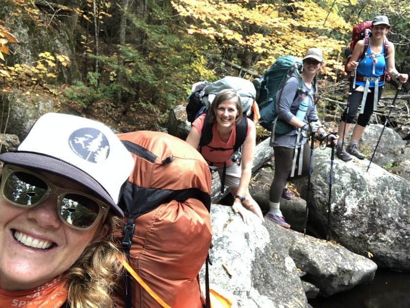
Getting the band back together (7 trail miles)
This trail is about a 5 or 6 hour drive from the twin cities area, so we all got up early, met in one spot, donned our masks and piled into Fancy Nancy’s passenger van. The van was great (Thanks Nancy!). We were able to space out, open windows, take air breaks and enjoy the feeling of heading out on an adventure together again!
The drive up went fairly quick and the closer we got to our destination, the more camouflage clothing we saw. It was a good reminder that small game hunting season starts early in MN. I brought a goofy orange safety hat to wear at the beginning of our hike, closer to the trailheads, and brought orange bandanas for my friends’ packs. After our ‘startling’ end to last year’s Superior hiking Trail trip, surrounded by the sound of gunshots, (video 8:05) I learned to wear orange from mid Sept through November in the Minnesota woods.

Hitting the Trail
By the time we got the trailhead, it was getting close to lunch time. We ate quick, did one last gear check and started our hike at BCAW Entry Point #15. Because of all of the shifting and cancelling of plans this year, this was the first time I’d had on a fully loaded pack for any distance since last Fall’s Superior Hiking Trail Finale. As I hiked, I wondered how my body would feel, how it would adjust, if I would regret not training…if I would remember how to backpack…if we would get lost. These anxious thoughts swirled around in my head for a while, and eventually came to accept whatever would be. My pack weighed just under 30 lbs with food and water, a little heavier than normal, but I wanted to be sure that I was warm, safe and well-fed if I was going to be out in the middle of nowhere.
As my mind sorted out it’s pre-trip jitters, the golden canopy of the forest opened up and took my attention. The Fall colors were peaking, and I was dazzled by the beauty all around us. The “stick” of the lollipop loop, is approximately 5 miles, mostly flat, but has a few challenging sections that beavers have re-routed for their convenience. A little less than half way into the hike to Devil’s Cascade, we got turned around in a swamp. There are no signs on this trail, so animal trails and beaver dams can quickly cause detours. It’s very easy to get turned around if you are not paying attention, so make sure you keep your map, compass and GPS handy, and know how to use them. We spent about a half an hour bushwhacking through brush in this section until we finally found our way back to “the stick”. I found myself thinking “WHAT ARE WE DOING???”


Back on the trail, we descended down in to a rocky entrance to the Little Indian Sioux River and saw out first small waterfall. It was a quiet, serene little spot that made us wonder about the Devil’s Cascade waterfall that we would camp by that night.

Devil’s Cascade
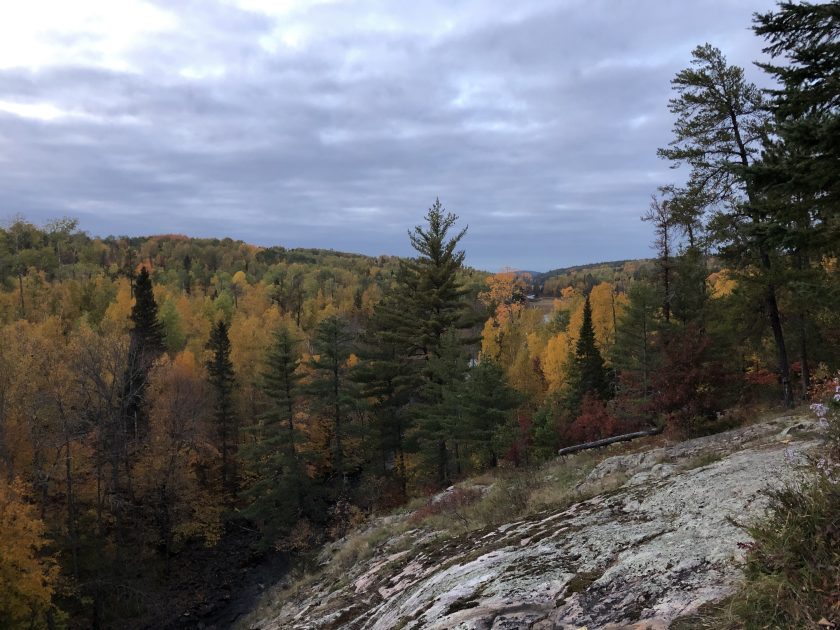
Campsite notes: We saw spots for 4 tents and at least 4 hammocks. Water source is a long walk down the portage trail on the East side of camp. The latrine is difficult to spot at first, but watch for the cairn directly south of camp. Nice fire ring with grate, standard in the BWCA. Large rock cliff overlooking the cascades and Northwestern view of the BWCA. This is a popular campsite, so, the Red Squirrels are brave and you might find a mouse in your shelter if you don’t zip up. Good spot to sit and watch the sun go down after a long day of hiking.
Onward, we hiked along at a relaxed pace, feeling a little bit tired from the early morning and long drive up. I didn’t wear a watch on this trip, but I think we made it to camp by around 5 because my stomach was starting to growl for dinner. As we approached the campsite, we heard the roar of the falls and followed their sound until we could see their source. We chuckled as we tried to comprehend how this campsite, high on a rock, with a steep cliff to the cascade could be considered a canoe-in campsite…we would find out later as we searched for drinking water access, that the eastern side of the campsite has a long portage down to the river.


The sun sets at around 7pm this time of year, so we quickly set up our shelters, and started making dinner. Tonight, I had homemade dehydrated spaghetti with veggies from my garden. I was worried that I made too large of a portion, but I gobbled up the whole meal, no problem. With a full belly and a happy heart, I stretched out, alone on the rocky cliff, surrounded by the colors of the forest and the sound of the rushing cascade, until the sun went down. I walked back to my tarp in the dark, feeling excited for the days that would come, and hoping that we would not have any bear visitors tonight.


I knew better than going straight to bed. On past trips, when hiker midnight strikes before 8, it just means that I wake up at 3am or have a terrible night’s sleep. So, I listened to an audiobook for an hour and tried to stay up just a tad longer than normal. Just as I was drifting off to sleep, in the pitch dark, I felt a little friend nonchalantly trot up my leg and sit on my hip! I was so tired, I thought I might be dreaming. I paused for a second and then calmly flicked the little mouse out the side of my tarp. I zipped up the netting on my Recon Bivy and then lay there with my heart pounding for a while, wondering if I would spend the whole night launching mice from my bed. They didn’t come back (or if they did, I slept through it)

Day 2: Devil’s Cascade to Emerald Lake
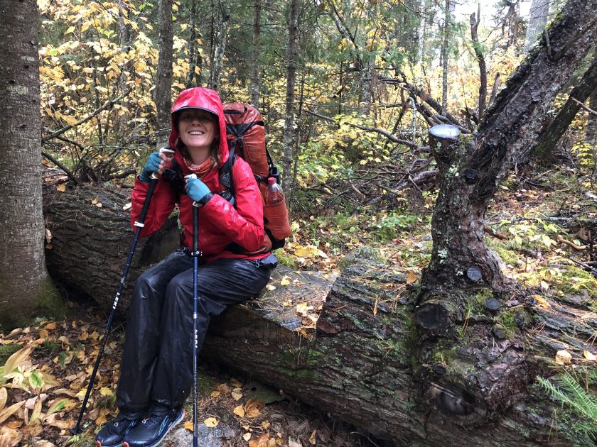
RAIN RAIN RAIN (15 miles including the Loon Lake portage)
Morning came, and we were excited to hit the trail! We loosely planned hiking the western side of the loop and staying at Range Line Lake. My only hope for the day, was to take a little side tour to Loon Lake and see Canada!

The first couple of hours of our hike were still on a well established trail. We crossed a few beaver dams, but they were much easier to navigate than yesterday’s detour. We stopped for a mid-morning break at the portage to Loon Lake. There, we saw our first people! A group of canoeists, portaging! I have never been on a traditional Boundary Waters Canoe trip, so I was fascinated as we watched them go by. One man had a HUGE portage pack that looked like it was about to burst and gear in both hands! Another walked by with a canoe over his head, carrying the canoe with one hand and some sort of briefcase with the other! And a third man walked by after some time, with a big backpack and an armful of gear. He seemed curious about our hike and kindly asked if we needed any supplies. His offer was nice, but after seeing all of the stuff they were hauling, I thought NO WAY! After they passed to go back for a second or third load, Andrea and I decided to make the 1.5 mile roundtrip detour to Loon Lake and check out the view of Canada. I was surprised at how close it was from the shoreline and it really started to sink in, how far up north we were. We spied large moose tracks along the long, sandy shoreline and talked about how amazing it would be to paddle on this lake.

A few drops of rain started, so we quickly made our way back to our friends. It wasn’t quite raining enough to put on our gear, so we looked at the map and plotted our way North to our next site. This section of the trail has had a lot of blowdowns from previous year’s storms and is a little trickier to walk on…we found ourselves climbing over, under or around more trees than previous sections. Not long after we got going again, the rain started. Steady. We geared up and kept plodding along the rugged trail.
Check out part 2 and our Youtube video for more magnificent Fall colors, campsite conditions and tales from the trail.
Have you ever hiked or backpacked the BWCA? Favorite trail or canoe route? Tell me about it!
Happy Trails!
~WP
Wandering Pine is reader-supported and some of our blog posts may contain affiliate links. Learn more here.
Thank you for your support!
Sounds like quite the trip… Anxious to hear the rest of the story. Stay dry! fingers crossed 4 u!
Part 2 posted today!
It looks like you had quite the adventure! I’m so glad you were able to overcome some of those thoughts of you not being ready. You seriously rock, and I bet you slept really well when you got home!
Thanks Sami-
It really was a great trip. Just what I needed! Have you been to the BWCA?