


TRIP DETAILS
LENGTH 50.9 trail miles (potential for several more miles with spurs, overlooks and side trips for ice cream)
DIFFICULTY Moderate with a brief flat section along Lake Superior’s Shore.
DATE June 5-7, 2019
MAIN FEATURES Panoramic overlooks of Lake Superior, trillium and lady slippers, never ending ups and downs and waterfalls through the stunning city parks and trails of Duluth, MN.

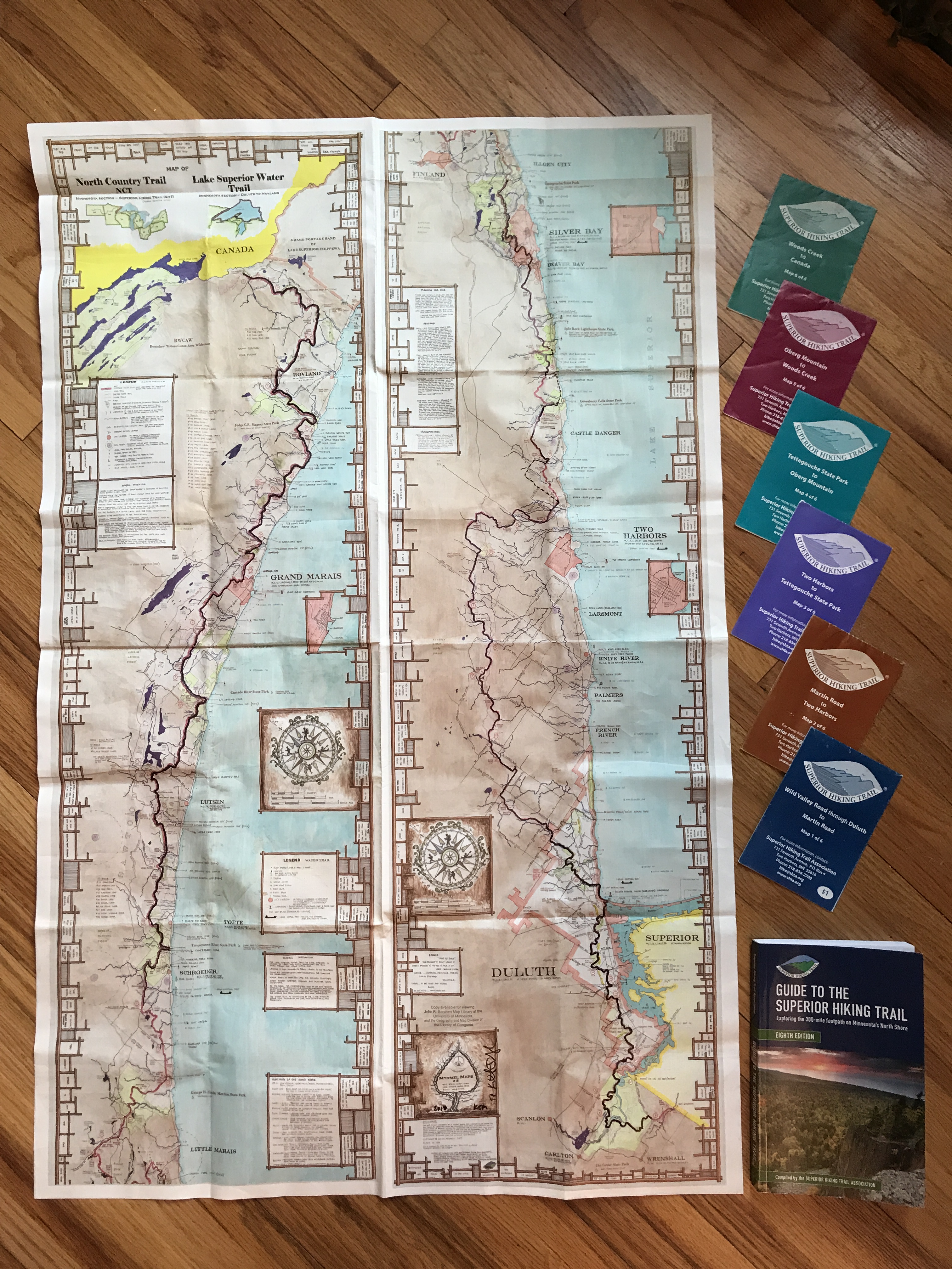
If you have been following my Superior Hiking Trail Adventure, I’m one section away from completing my SHT LASH, and am so happy with the way it’s all come together! My sister and I set out to thru hike the entire 310 mile trail in September of 2018 and came off the trail after approx. 100 miles. It’s exciting to have been able to complete 3 large sections (the purple map, brown map and all but the very tip of the blue map) in a around 10 total days on the trail within the last 3 weeks.
Some hikers are less interested in these two southern sections of the trail because it lacks the terrain and remote views that are found in the Northern Sections, or they opt out of the Duluth section on their thru hike for the sake of time and overnight logistics. Both of these sections were remarkably beautiful in their own way and if you are planning a thru hike, don’t let hiking through the city deter you. It was one of my very favorite parts of the trail, popping in and out remote nature trails, into the city and then back onto the trail again. Don’t discount this gem if you can swing the extra days on the trail, it’s totally worth it!
It’s like a thru hike with a bunch of zero days…
My friend recently said my LASH “is like a thru hike with a bunch of zero days in between”…except those zero days aren’t really zero days…my days are full of work, sports/school/scout events, shuttling teenagers and keeping up on regular life stuff.
I occasionally get asked in a certain tone “are you ever at work?” and “what does your husband think about all of this outdoorsy stuff?” my answer is, you will make time for the things you love to do. I squeeze much out of my hard earned weekend and vacation days as possible and couldn’t pull it off without the support I receive from both home and work!
AND…since we’re talking… please don’t take my instagram as a real-time thread of my life. Please. It’s a place where I share stories and celebrate the things I am inspired by and discovering along the trail. Its all real… just not happening in real time. I don’t usually post in real-time for privacy and to stay a little more present in the moment.
About those 25.8 wander-miles…
One of the biggest things I learned after our September trip was that I wanted to make my focus less about the miles and more about the experience. If you are trying to accurately track or plan your daily mileage, the variations between the maps, guidebook, online distance calculators, gps, pedometer apps can give a range of results. Its good to have a general plan and then leave a little room for exploring overlooks, getting turned around, checking out campsites, and even venturing out for ice cream or climbing up a historic tower! I could easily add a couple of miles to a long hiking day doing those things, and haven’t regretted slowing down and enjoying the trail. I remembered I had a health app on my phone and looked at it after our 2nd and 3rd day of hiking. I probably didn’t really hike 25.8 miles on my last day since step-based trackers can vary so much, but am bringing it up because it reminded me of how much additional exploring I actually do!
For the sake of this post, I will refer to the miles as they are listed in the guidebook because they include the trailhead spurs, which we took every day since we were not backpacking.


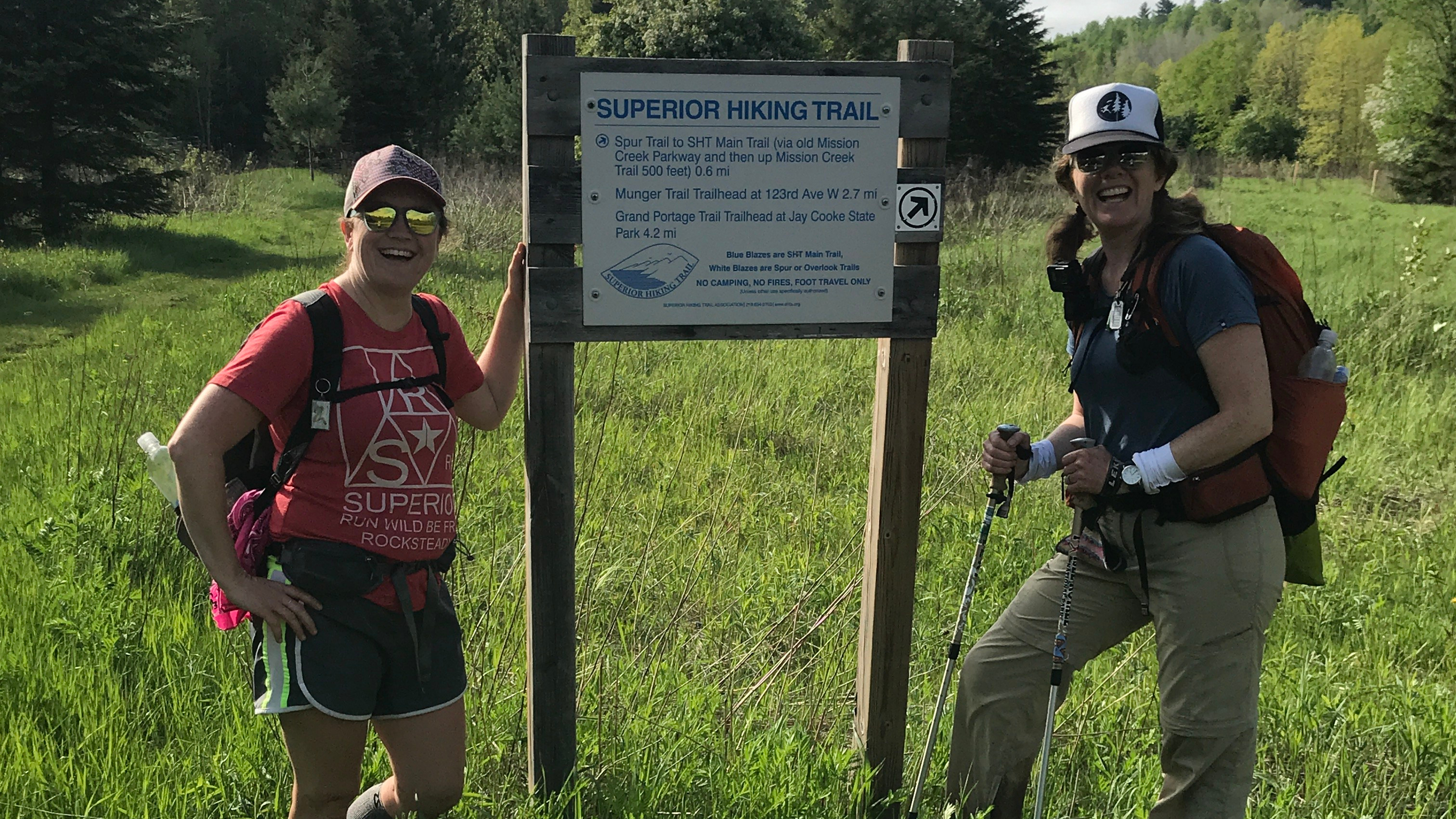
My friend, Pam and I drove up from Minneapolis and arrived at the Wild Valley Road Trailhead at 10:30. The forest is popping green and in full bloom! Today we saw the forest crowned in it’s Spring glory, blanketed with trillium, clematis, fern and at least a dozen yellow lady slippers.

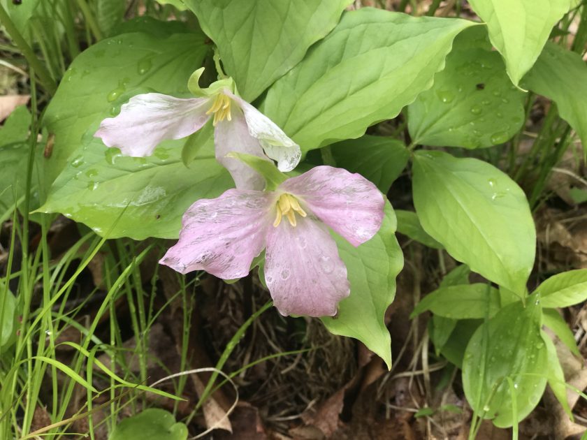
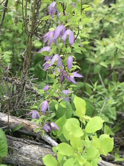
Up against against the raging river rapids and endless eskers, the flowers still stole the show. I had never seen a yellow lady slipper or moccasin flower before and had only seen pink trillium at Charles Lindberg State Park.


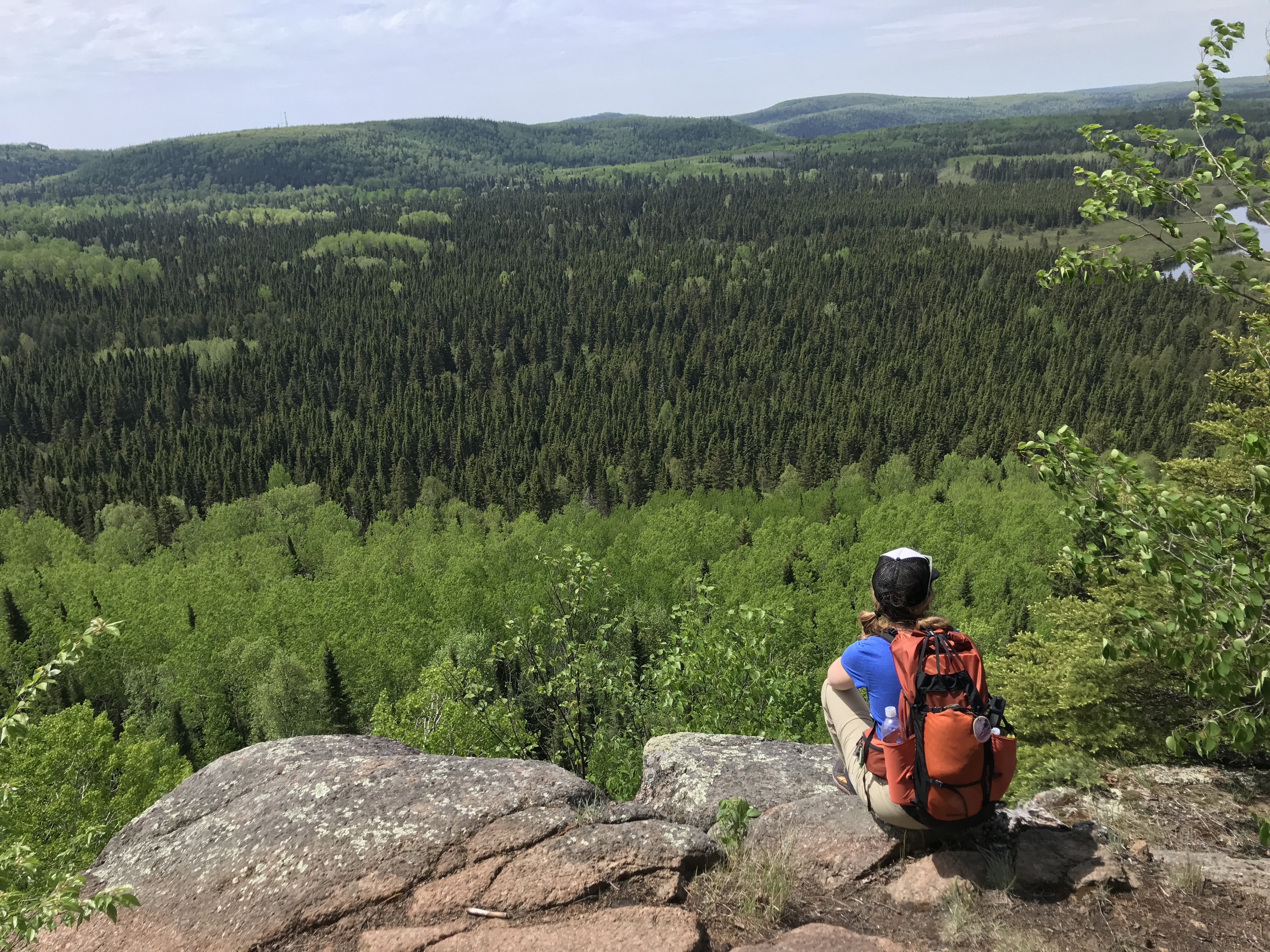
I used the map, before the trip, to figure out how to divide up the section but didn’t really realize that the first leg winds almost entirely through Jay Cooke State Park. The park is enormous and it literally took all day to walk through it. I would love to come back and explore every nook and cranny of it!


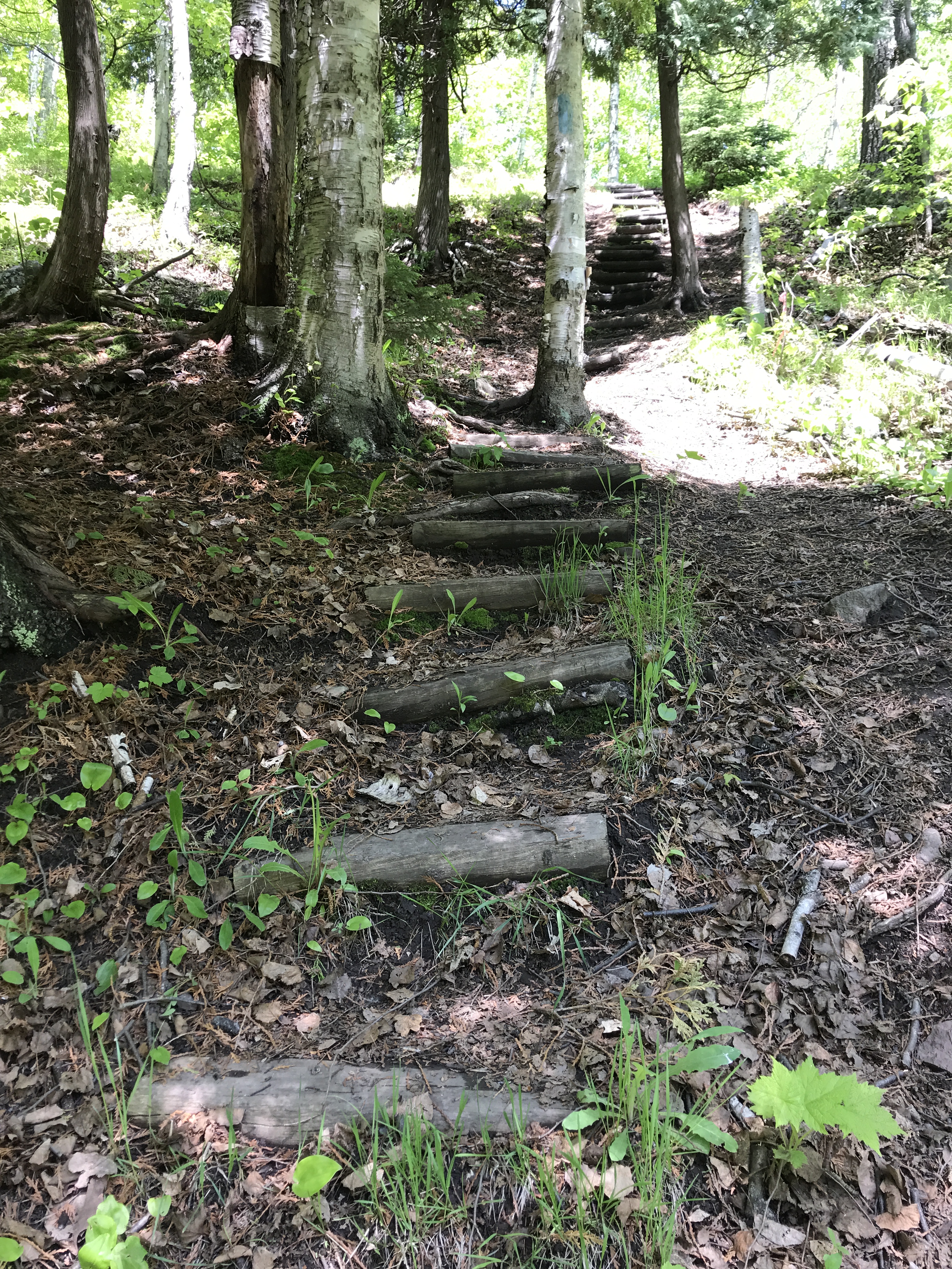
The trail continues to duck in and out, crossing the road a couple of times. There were a couple of hefty climbs in this section but the single-track trails along the eskers were also one of my favorites. It reminded me a little of Savanna Portage State park, with the skinny ridge lines.


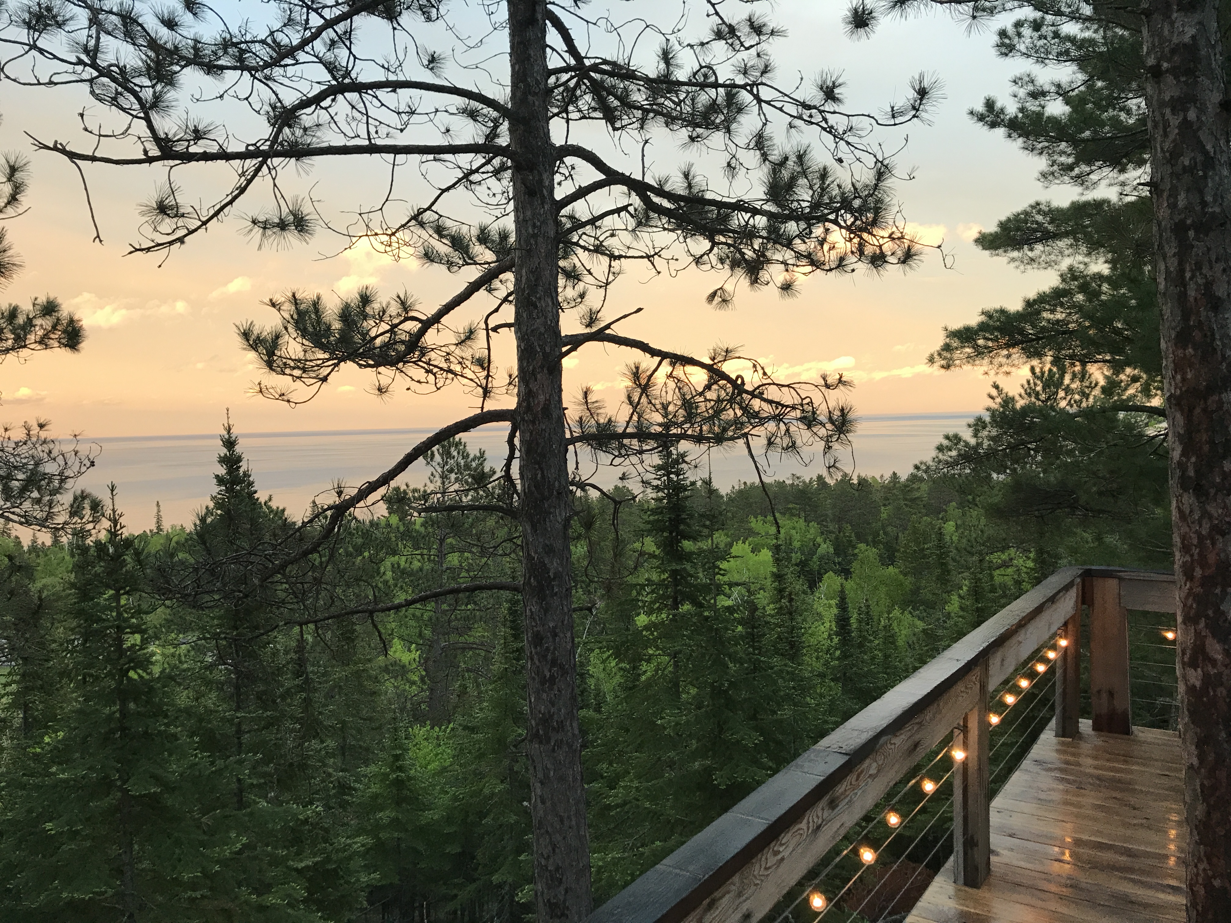
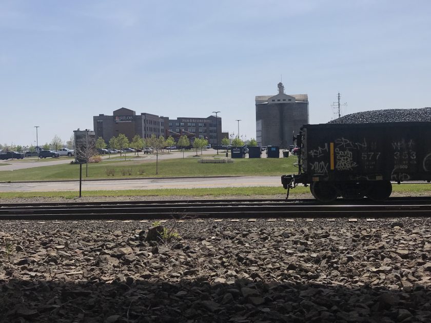
Today we saw the last of our eskers on Mission Creek and powered over Bardon Peak, Ely’s Peak and Spirit Mountain. This was our biggest elevation day and the views of the St Louis River, Spirit Lake and Lake Superior were amazing.


Our hike started in thick forests o’ fern and landed us at the Ely’s Peak parking lot and paved trail. We hoofed it up to the top, to find an amazing panoramic view and unfortunately, some toilet paper, a dirty old sock and beer bottles! We hauled out all of the trash we found and kept wondering if we had reached the peak or not…it just kept going!

From there, we headed through Magney Snively to Spirit Mountain. I was relived to finally get to weigh and dump all of those clanky beer bottles at the Spirit Mountain Chalet before our climb.


The trail had a little mud in sections and just re-opened to the public within the last 3 weeks or so. It was about 80° and I managed to avoid getting the dreaded hiker’s rash by only taking very short breaks and immediately elevating my legs for about 20 minutes afterwards. According to my health app, we had already hit 20 miles and cut the Brewer loop section from our day.
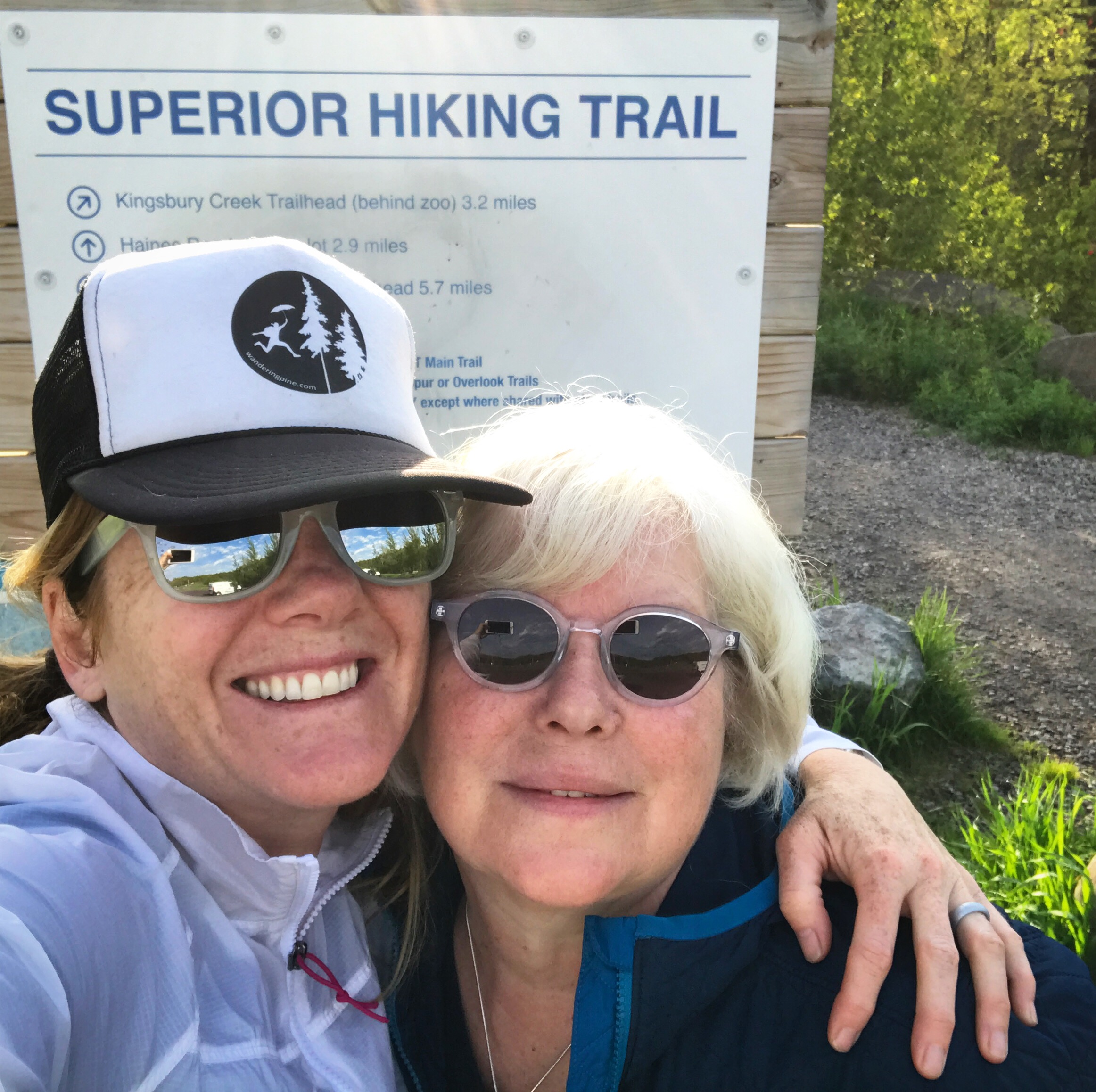
Pam headed back home and our Trail Mom, Kim, and I headed to the Duluth Grill for a local beer, Fish Tacos and Bibimbap!
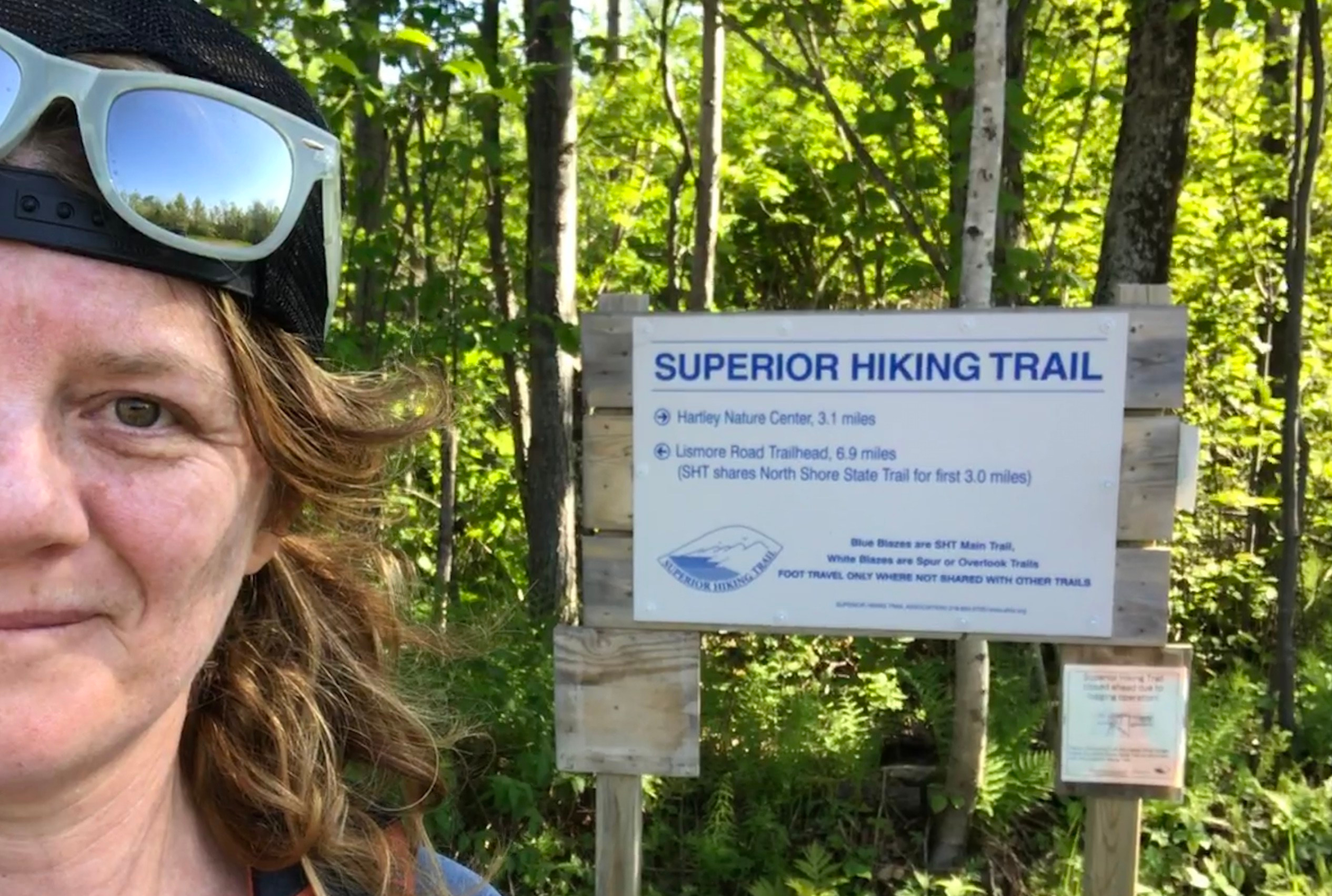
Day 3: Skyline/Highland to Martin Road-18.8 miles
Today I will hike at least 20 miles alone through the city. I hope to make it to Martin Road where my family will pick me up before our summer vacation. Looking forward to a big ice cream cone and walking along the shore at canal park!

I don’t typically hike alone. I like company. But today, I was actually looking forward to the time to myself. Trail Mom launched me off early with breakfast, a pep talk and a hug at the trail head. It was a little like being sent off to my first day of school and I adored it.


Next up, Enger Park! I really didn’t know what to expect as I inched toward the giant tower through the morning’s hike. There it was…this mysterious landmark in the distance…and I knew the climb down into the city would follow immediately after. The first thing I saw when I entered the park was a beautiful Japanese Garden with an invitation to ring and enormous peace bell with a long swinging board. I didn’t see any “DO NOT TOUCH” signs ( I double checked)…SO I GAVE IT A HEFTY WHACK! It had such a lovely sustaining tone that I actually stood there, still, until it stopped ringing.
I headed down to the parking lot to empty and recycle my bag full of trash. I knew this would be a high mile day…but I just couldn’t pass up the opportunity to climb Enger tower.

I did eventually find the trail back out after consulting my phone’s GPS app and scurried down the hill. It was almost 11am and I wanted to be at canal park by 11:30. At the bottom of Enger Hill, I got turned around AGAIN at “twin ponds”, and tried to blend in with an adorable kindergarten class on a field trip. We crossed the street together with their helpful teachers. One boy exclaimed “YOU’RE A HIKER!” I nodded and didn’t tell him I was lost. I wandered around the parking lot for a while and finally circled back to the trail and walked past the kindergarten class again…standing tall, head held high, trying to look like I knew what I was doing.
I hiked down the hill quick, crossed the freeway bridge, bound for Canal Park!
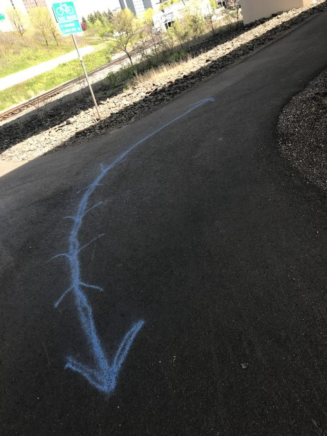

The thing I liked most about hiking though Canal Park, a busy tourist destination right by Lake Superior’s shore, was spying for the tiny SHT signs, blue blazes, and blue arrows on the sidewalk. It was like a scavenger hunt! I have been to that area several times and missed the SHT signs…this time I felt like a cool dirt bag thru-hiker on a town day, even though people kind of looked at me funny.


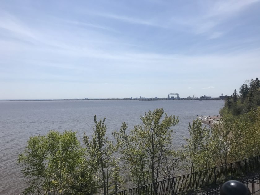
The pebbly hike on the lake shore was another highlight of the day and before I knew it, I was huffing and puffing up the hill to Chester Park!


I walked through another residential area and then to Bagley Nature area and Hartley Nature Center. I noticed a sign for a campground at Bagley and remembered that there were camping options at Bagley, U of M , Spirit Mountain and Fon Du Lac for hikers looking for accommodations in this section.

The day was going great, feet and body felt good and I was enjoying hiking alone…but it was around this time that I discovered that somewhere today I totally blew out my SHOE! (which the good people at Altra are already replacing! THANK YOU!)

After a mile or so through another neighborhood, the big green blob on the GPS map ended up being a cemetery! Nice and flat…plenty of shade….even on a dirt road! It was a nice break from the roots, rocks, hills and pavement my feet had endured today and I took advantage of it!
I took some time to reflect on and appreciate my life, as I walked though the monuments and headstones. And the trail picked back up and continued about another mile or two to Martin road. I only saw one person on this section and he was cruisin’! I started to hear the sound of a road, and there it was, just like that….MARTIN ROAD!


Miraculously, no blisters. Same pair of socks all day.


Although I originally planned to thru hike all 310 miles of the SHT in one shot, I’m grateful for the way this journey has turned out. Its been wonderful to be able to wander in and out of campsites, overlooks, spur trails, and fully enjoy the trail in my own way without feeling like I need to complete it in a tighter timeframe. I’ve also met some pretty incredible people and appreciate all of the support from my family, friends and hiking community on this adventure. I’m planning on focusing on other outdoor adventures summer, sifting through all of the GoPro videos and finishing the final section in the Fall. I have about 50 miles left and get all sappy thinking about closing out my LASH during one of the trail’s most beautiful times of the year.
If you would like to follow along on the last 150+ miles, and read future posts about some of the things I learned along the way, hit subscribe to stay up to date. Check out the WanderingPine YouTube for updates as well. Please be patient with me, I’m learning about video editing, it’s slow going on my computer and I would rather play outside…
Have you ever hiked the Duluth section?
Do you have any great apps or low tech ways you track your actual miles?
Happy Trails!
~WP
Wandering Pine is reader-supported and some of our blog posts may contain affiliate links. Learn more here.
Thank you for your support!