
Wandering Pine is reader-supported. When you buy through our links, we may earn an affiliate commission at no additional cost to you. Thank you! Learn more.
I started to feel light and frolicsome…as though I had wings…
Welcome to Part 2! If you are new to the series, here’s a handy link to Part 1. If you would like more detail on each section of the Superior Hiking Trail, check out their page and feel free to visit my trip reports linked in each summary below.
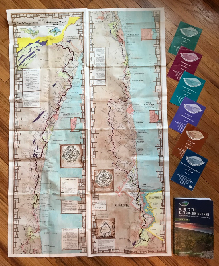 Purple, Brown, Blue, Teal…
I needed a plan to finish the trail and wasn’t sure how to do it. I assumed I would just hop back on where I left off and head south until it was done. I had hoped to hike sections in October of 2018 and Snowshoe part of it in the early Spring of 2019, but my body and Mother Nature had other plans. Spring came slowly, and waiting was hard. It seemed that every trail was socked in with snow or apocalyptic mud until May. As each plan fell though for one reason or another, I took it as a sign and tried to remain open instead of forcing it. A group of friends called ‘The Blister Sisters’ started planning their annual Spring backpacking trip, and I asked them if I could join. That trip ended up covering the entire Purple Map and inspired me to hike the rest of the trail in 50+ mile sections, completing each one by map color. Until then, I hadn’t considered the trail in sections, it was always a 310 mile ‘one shot’ deal. Shifting my mindset from ‘thru-hiking’ to ‘section-hiking’ and finishing one whole map at a time kept me motivated and made me feel like I was doing something big!


The Purple Map
By the time I set my feet on the Purple Map, I’d had a whole winter to recover mentally, and physically, read a 300 page book about foot care called ‘Fixing Your Feet’ (game changer!), and another book about Forest Bathing (which slowed my roll). We finally had our conditions squared away and off we went! On the trail, we found snow, shoe-sucking mud, climbed the newly remodeled ‘drainpipe’ (a 150′ rock crevice monster that eats ankles and hiking poles), saw Bean and Bear Lake in the rain, and experienced heart-swelling views of Lake Superior through bare trees. I learned how to improvise when my sleeping pad was not warm enough and I woke up shivering, to walk straight through ankle deep mud, started picking up every piece of trash I could find on the trail and experienced the satisfaction of hiking a few more miles each day to knock a whole day off our trip and beat a storm. ‘The Blister Sisters’, an amazing group of 7 women, welcomed me into their group and helped me regain my confidence to get back on the trail. With their help, I reached 150 miles, the half way mark!


The Brown Map
The Brown map is a suitable color for a hike that was basically 60 miles of mud. We also found shin deep water, snowmobile trails, barren logging areas that were interesting to navigate, and some sideways rain, just for fun. Our ankles twisted with nearly every step but we enjoyed this section’s beauty regardless. My favorite part was walking through the re-forested areas in the fresh spring, and seeing the different stages re-generation. Two weeks after the Purple Map, Jessica (Prank) and I hit the trail on Memorial Day weekend, meeting Boy Scouts, Bush crafters, Trail Runners and a couple dozen other nice people. It was Jessica’s first real backpacking trip, and she inspired me with her grit, positive attitude and quiet strength. She’s also hilarious and quite the prankster! We saw a porcupine in a tree, experienced a holy moment at the Scout’s campfire church service, came face to face with an ATV biker gang (ok, they were just a nice family), learned to double check our water sources, were grateful for head to toe rain gear, and left the trail feeling stronger than ever for pushing through some really tough conditions. We ended up having a couple of big mile days, but I usually didn’t know exactly how far we were hiking until Jessica gave the fit bit mileage report at the end of the day. The 6 hour drive home from Duluth in Memorial Day traffic was the hardest test on my tired ‘shin-ankle’, but I’m grateful for this section with Jessica. Instead of breaking us, the brown map refined us and made us both stronger!


The Blue Map
A few weeks later, in June, I came home telling everyone that the Blue Map was my favorite section and that I wanted to live in Duluth! We didn’t camp on this section due to the logistics of finding campsites and Trail Mom’s AMAZING offer to host us each night and shuttle us to and from the trailhead. Kim (Trail Mom) is the best and I love her. She hugged me each morning at the trailhead and put beer and cookies in our room each night! Pam joined me again for two out of the three days and I enjoyed the last day solo, exploring Duluth. Day hiking with a lighter pack gave us a chance to cover more miles on a section that many thru-hikers skip. The southern section of the Blue Map is remote enough that we still carried our 10 essentials and a tarp just in case. Most of this section winds through Jay Cooke State Park, several other regional parks and has some good hills to get the heart pumping: Spirit Mountain, Ely’s Peak and Enger Tower. Only a small section of it runs through the city proper, but when it does, that’s beautiful too! On day 3, I climbed the tower and rang the giant peace bell at Enger park, got a huge ice cream cone at canal park, smelled the flowers at the rose garden, stared at Lake Superior’s crashing waves for a LONG TIME and crossed the street with a group of preschoolers on a field trip when I got lost just before entering the city. I only ‘cared’ about my pace on the last 3 miles when I had to hurry up and get to the trailhead for pick up.


I started to feel light and frolicsome…as though I had wings…HEY! I TOTALLY HAVE WINGS!
At Martin Road, the end of the Blue Map, my iPhone pedometer read 26 miles by the time I hobbled to where the car was parked at the Martin Road Trailhead. My husband was waiting for me at the end to celebrate our 26th wedding anniversary, making that day one of the highlights of my whole adventure! I really don’t know or care if my iPhone’s GPS is accurate or not, but the symbolism was perfect and we still dream of living on Lake Superior one day.


I intentionally took the summer off from the SHT. Hiking long distances in the heat doesn’t always work for me since I have something called exercise induced vasculitis, ‘hikers rash’ or ‘the Disney rash’. It’s no fun. You can read more about it here and also this interview that the Duluth News Tribune did with me on the subject. My sister still gives me a hard time about being tracked down by a newspaper photographer on the trail during our shakedown to talk about my embarrassing rash. And she likes to point out that the picture of my ‘rash leg’ is the first thing that comes up when you google my name. It is actually pretty funny. Here’s an awesome update though: I didn’t end up getting the dreaded rash at all this summer and I think the biggest difference has been that I immediately elevate my legs straight up in the air if I’m on a break and for at least 10 minutes after finishing a long hike. Try it and let me know if it works for you!
The Teal Map
Finally! The Teal Map! Trip planning had become easier with each section and I started to care less about the miles and calories and think more about what I could experience on the trail. Instead of creating a detailed itinerary, I tried to divide the miles into even chunks, lowering my previous mileage goals in order to see more and be a little kinder to my body on this hilly section. My food prep consisted of eating whatever I had leftover from past trips and I didn’t worry about carrying a few heavier items if it meant I would be comfortable in cold rain. My family still had to watch me run around the house and get everything packed (sometimes a little anxiously). So, before heading out on my final trip, I was talking to my youngest son about being a little excited and nervous about finishing the trail.
He gave me some solid advice:
“don’t rush, stay out there until you run out of food, have fun and maybe just do like 5 miles a day.”
Why didn’t I talk to him first?


The Teal Map was the most jagged section, elevation-wise. Unlike other trails, the SHT doesn’t really have switchbacks, you just walk straight up and down; over and over and over! This section was worth every hard-earned step, showing us the most spectacular views of Lake Superior and Fall foliage. How could I know that the best section was just ahead of us when we ended our thru hike at Temperance River or that I would finally experience the joy of slowing down and truly savor the experience? I was not in the same frame of mind on our thru hike, so I am very grateful for the opportunity to break it up and save this glorious section for last. I appreciated it.


The Fall colors were popping and I stopped to take 43 pictures of mushrooms (yes, I counted!) instead of worrying about ‘making the miles’. If you go back to my original 100 mile recap, one of my deepest regrets was not slowing down to take more mushroom pictures. It felt good to be so close to the finish but also know that the miles were not the most important thing anymore. It was still cool to see Andrea’s Garmin stats at the end of the trip:
Mileage: 60.69
Time: 33 hours 38 min
Elevation Gain: 7,391
Elevation Loss: 7,161


Most of the Teal map was spent with Andrea and Angie. Andrea had just ended a thru hike early at Temperance River and this was her first trip back on the trail. Angie was part of the Purple Map Blister Sister Crew and ended up kind of ‘accidentally’ completing over 100 miles on the SHT this year! We camped our last two nights with Fancy Nancy and the Thrive 5 and laughed through the whole trip.
I sang at the top of my lungs in the rain, ran through shin deep mud, ate lunch in my underwear overlooking Lake Superior, shouted multiple words off of Fantasia Overlook to hear the echo of my voice, laughed until I cried, cried until I laughed, survived the ‘aftermoth’, and still remember all of our giggling about carrying around my green LNT Deuter Dirtbag full of of a dog poop bag and onions we found at Egge Lake for 20 miles.


We did it!
The gals joined me on my final couple of miles back down to the Southern Terminus to finish the journey. I wasn’t sure how I would feel when I saw that sign, but once we got there, I just felt light. I wasn’t sure what to do with myself, so I asked them to leave me there alone for a few minutes….and I just sat there, being present. No fireworks, happy dances, big ugly tears, landing dramatically on my knees… I just felt happy and light.
Then my mind went straight to tacos. So we hiked out of there quick and celebrated by living it up with Trail Mom, Tin Cup and a belly full of Fish Tacos and Beer from the Duluth Grill… and I returned home feeling like my favorite Mary Oliver poem, light and frolicsome, improbable, beautiful as though I had wings…and maybe a little more like my true self.
This is the second installment of a 3 part post. To read about the first 100 miles , our itinerary and what I learned along the way, feel free to hit subscribe or check back for updates on new content.
Happy Trails,
~WP
Superior Hiking Trail | Part 1: Thru Hike
Next up:
Superior Hiking Trail |Part 3: My Hike
You’re a good story-teller, Jen. I found one of your statements to aptly describe the SHT…’the SHT doesn’t really have switchbacks, you just walk straight up and down; over and over and over!’ Yup! That’s the SHT!
Loved catching up on your grand adventure :). Can’t wait for the final installment.
Thanks Melissa! Appreciate your support along the way!
Great post! Brought back memories of northern MN which I loved. And what great advice – slow down, look, take photos of dozens of fungi. Walking these should not be a matter of completing miles but becoming part of the world you are moving through.
Thanks! I wish I’d learned that sooner, but we are all on our own journey. Happy trails!
your opening photo. Am sure I have sat at that exact spot. Is that near Bean Lake?
My cover photo is of Fantasia overlook. But Bean & Bear is a popular overlook thats not terribly far from that section. I miss it!