
Wandering Pine is reader-supported. When you buy through our links, we may earn an affiliate commission at no additional cost to you. Thank you! Learn more.
TRIP DETAILS
LENGTH 53.2 miles Tettegouche State Park to Two Harbors
DIFFICULTY Challenging: elevation, roots, rocks, snow and mostly mud
DATE May 14-17, 2019
MAIN FEATURES Panoramic overlooks of Lake Superior, inland lakes, and a never ending series of ups and downs through the forests of Minnesota’s North Shore.
It’s about time for a trip report! If you have been reading, you will know that I set out to thru hike the entire 310 mile Superior hiking Trail in September of 2018. My sister and I hiked approx. 100 miles from the Northern Terminus to Temperance River before pulling off the trail for health reasons. I have been thinking about hiking the last 210 miles ever since. I’m grateful for those 100 miles together and learned a lot from it.
 Since last Fall, I have spent more time hiking but less time focusing on speed or miles (see Forest Bathing), read a 300+ page book about foot care, readjusted some gear and made friends with the stairs in my building.
Right after we came off the SHT last Fall, a gal in another hiking group told me it sounded like I did a “LASH”. LASH = Long-Ass-Section-Hike. That was the first time I had heard that term. I like it and I’m keeping it. Off we go!
 Day 1: Tettegouche to Penn Creek- 9 miles
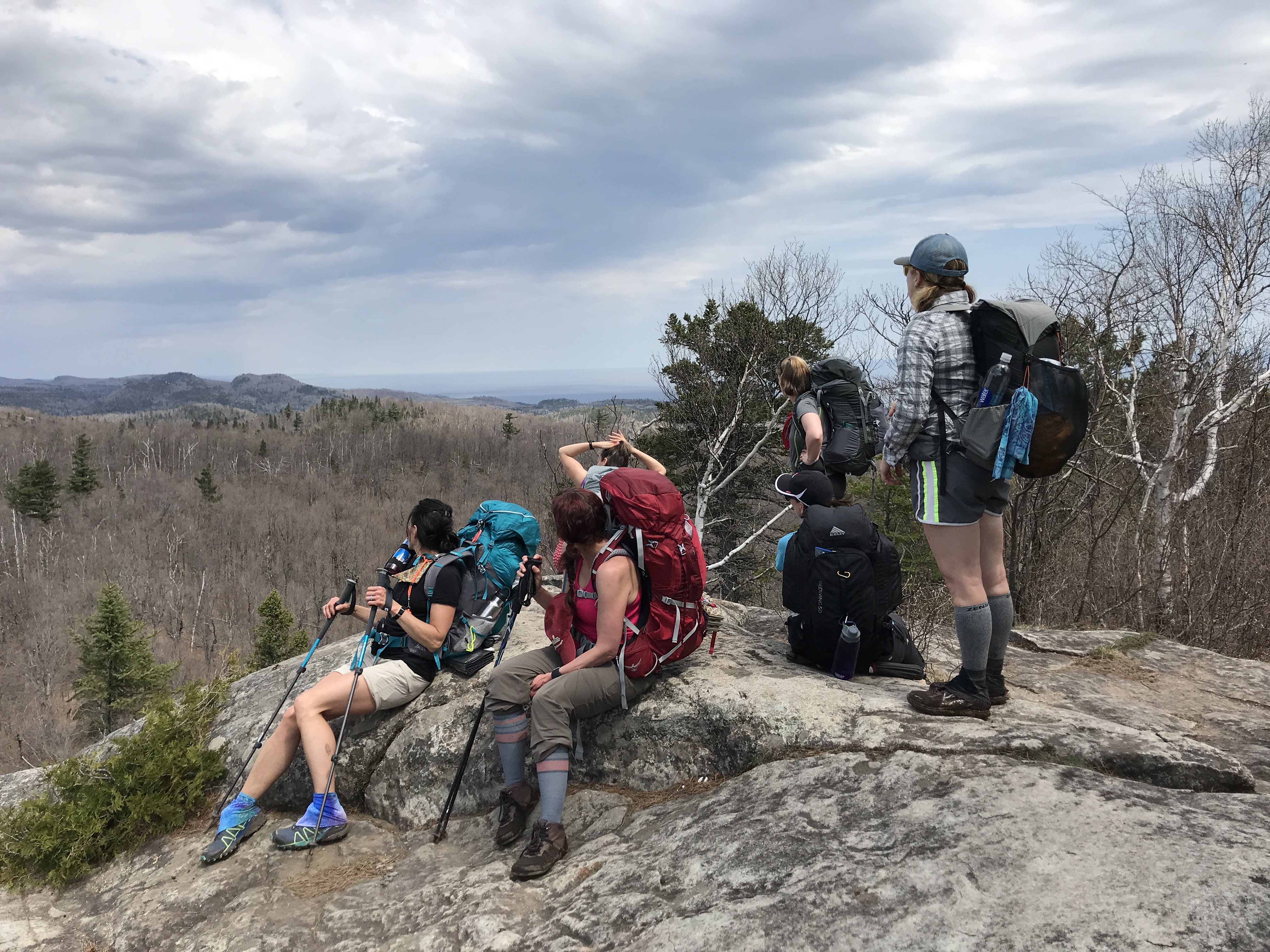
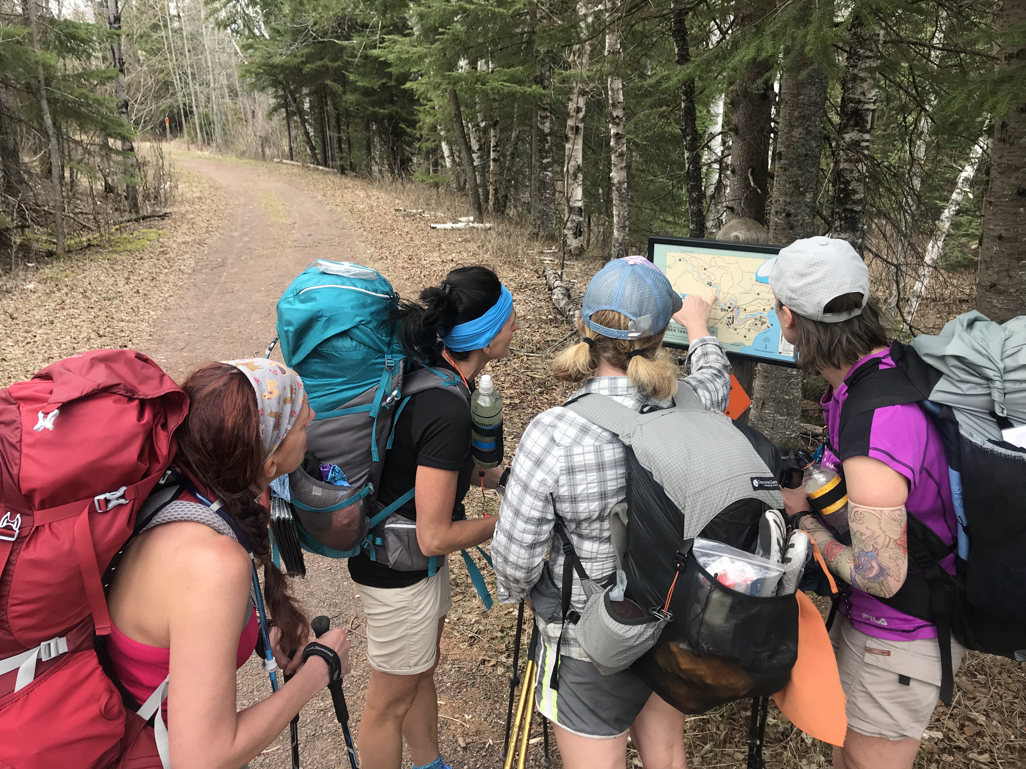
On Tuesday morning, our group of 8 “Blister Sisters” piled into two vans and headed North for an early start.
 One last pack weigh in put me at 24.7 lbs. with the extra food and as soon as we hit the road, all of those self doubts I’ve been hauling around since last September went out the window! Our plan is to hike 5 days to Two Harbors, splitting the group at day 3.


Our hike started slow and muddy with a big climb right away. This area had close to a foot of snow a week before, rain in between, and left us with the gift of ankle deep mud. We stayed on the trail, as not to widen it, looking for roots and rocks to hop along, but eventually we all just embraced it and walked right through it. I put on my waterproof socks and they worked great at keeping my feet dry for 2 days! (Then they took another 2 days to dry, ha!) I knew I had to take care of my feet on this trip if I planned on hiking 150 miles in the next 3 weeks.


I stayed in the back of the pack, intentionally, slowing my pace and enjoying the blooming flowers and the color of the leaves on the forest floor. Savoring the experience (even the mud).
 The temps were about 10 degrees warmer than forecasted and it rained! Its hard to say whether or not this 9 mile day was our most challenging, but it brought us through some of the most beautiful scenery the North Shore has to offer, most of it being in my favorite State Park.


The SHT winds through Tettegouche State Park, along the Baptism River, High Falls, over the suspension bridge and through many other popular areas of the park including the Drainpipe, Raven’s Rock, Mic Mac Lake, Mt Trudee, Round Mt, and Bean & Bear Lake.
 You could say I “went down the drain” the last time I was on this section of trail. I remember climbing DOWN the slippery “Drainpipe” in the rain, carrying a 40+ lb. backpack on my very first backpacking trip with the Scouts. This time there was a brand new set of stairs leading us up and I was hauling 20 lbs. less! The Drainpipe is a very steep crevice in the trail with a mix of boulders and loose rocks that (some) hikers used to have to basically crawl on their hands, knees and butts to get up and down. Some nostalgic folks were sad to see the old drainpipe covered by a set of stairs, but it was fine by us! Thank you SHT volunteers!
(Insert awesome Go Pro Photos here someday…it was raining!)
The trail continues on a series of rugged ups and downs and finally led us to the Bean and Bear Lake overlook. It was raining and the wind was whipping when we got there, but we still got a chance to enjoy the iconic view of the two lakes.


A steep descent led us to camp for the night at Penn Creek. It started raining as soon as we set up, so we popped up our shelters quick and sat it out for about an hour. I missed my umbrella as I cooked dinner trying to shelter my stove with my poncho and ate (very carefully) under the vestibule of my tent. I had one last homemade dehydrated ‘taco in a bag’ meal, that’s been in the freezer since September and it was just what my body needed!
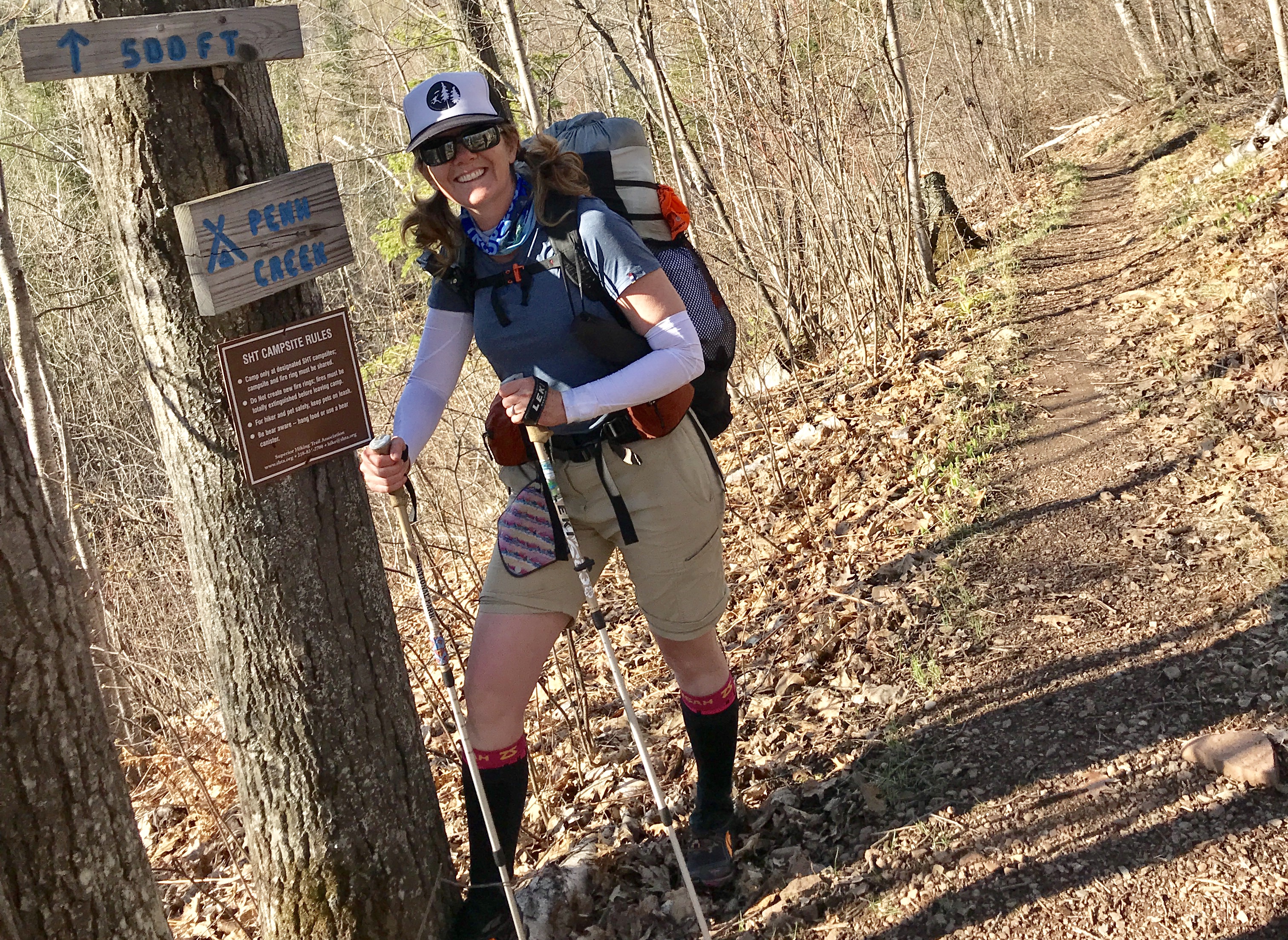 The Penn Creek campsite is beautiful with a good water source this time of year and plenty of room for tents and hammocks. After the rain stopped, we heard a repetitive thumping sound…. someone thought it was a beaver… another person thought it was an engine of some sort starting up every few minutes… it was a GROUSE! A grouse had become quite attracted to my little solo tarp tent and tried to impress it with its persistent wing-flapping for HOURS… even into the night and the next morning! What is it with me attracting birds?
Hiker midnight struck at about 8pm and we were all off to our beds.
Day 2: Penn Creek to Chapins Ridge- 14.4 miles
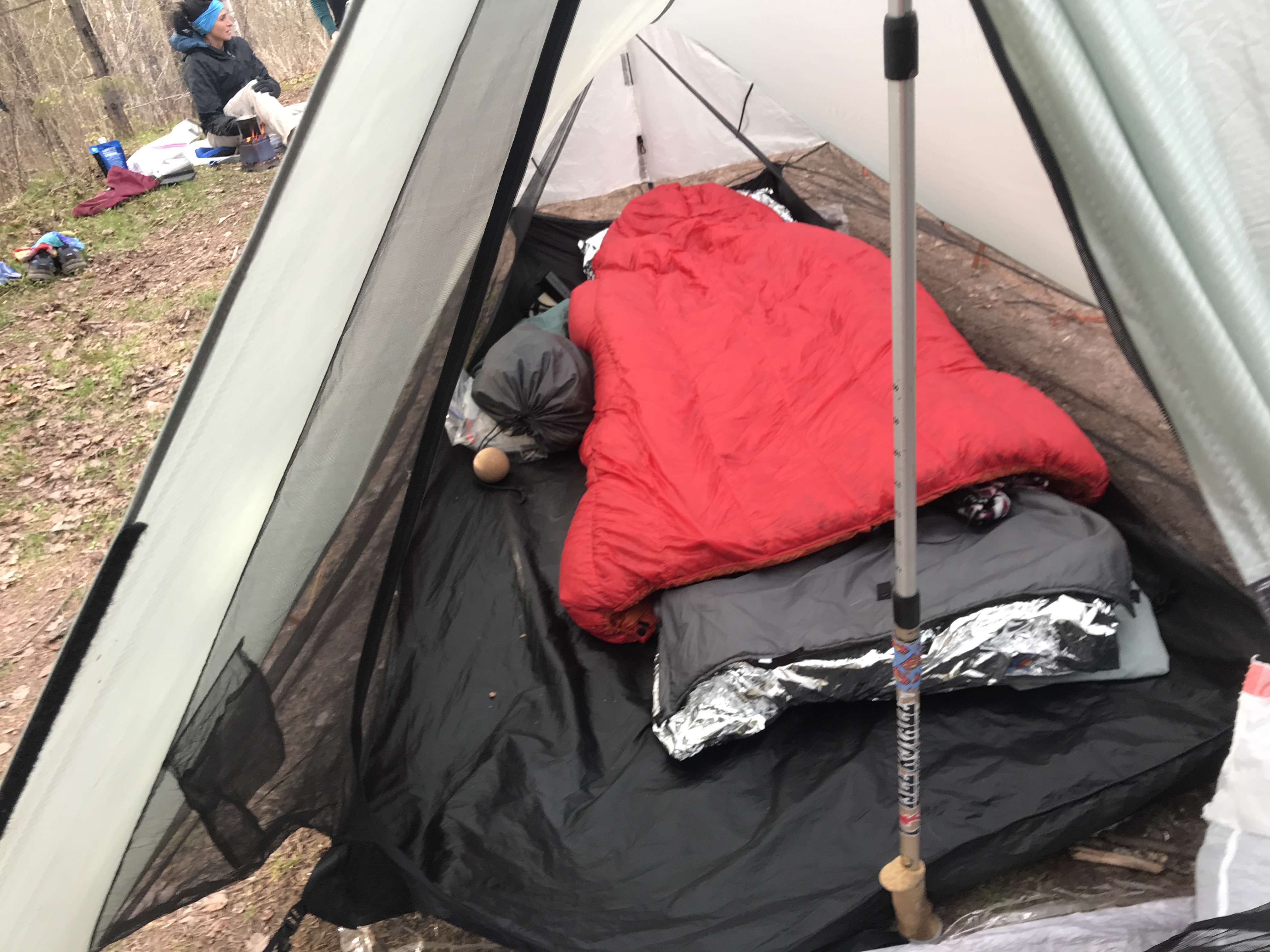
I woke up cold a few times and realized that my Big Agnes Insulated AXL air mattress was not going to be warm enough for the mid 30 degree temps at night. My quilt side felt toasty, but my pad felt cold to the touch under my back and just couldn’t keep me warm. The wind was blowing in on me through the openings on the sides and I had to line my gear up as a wind block.
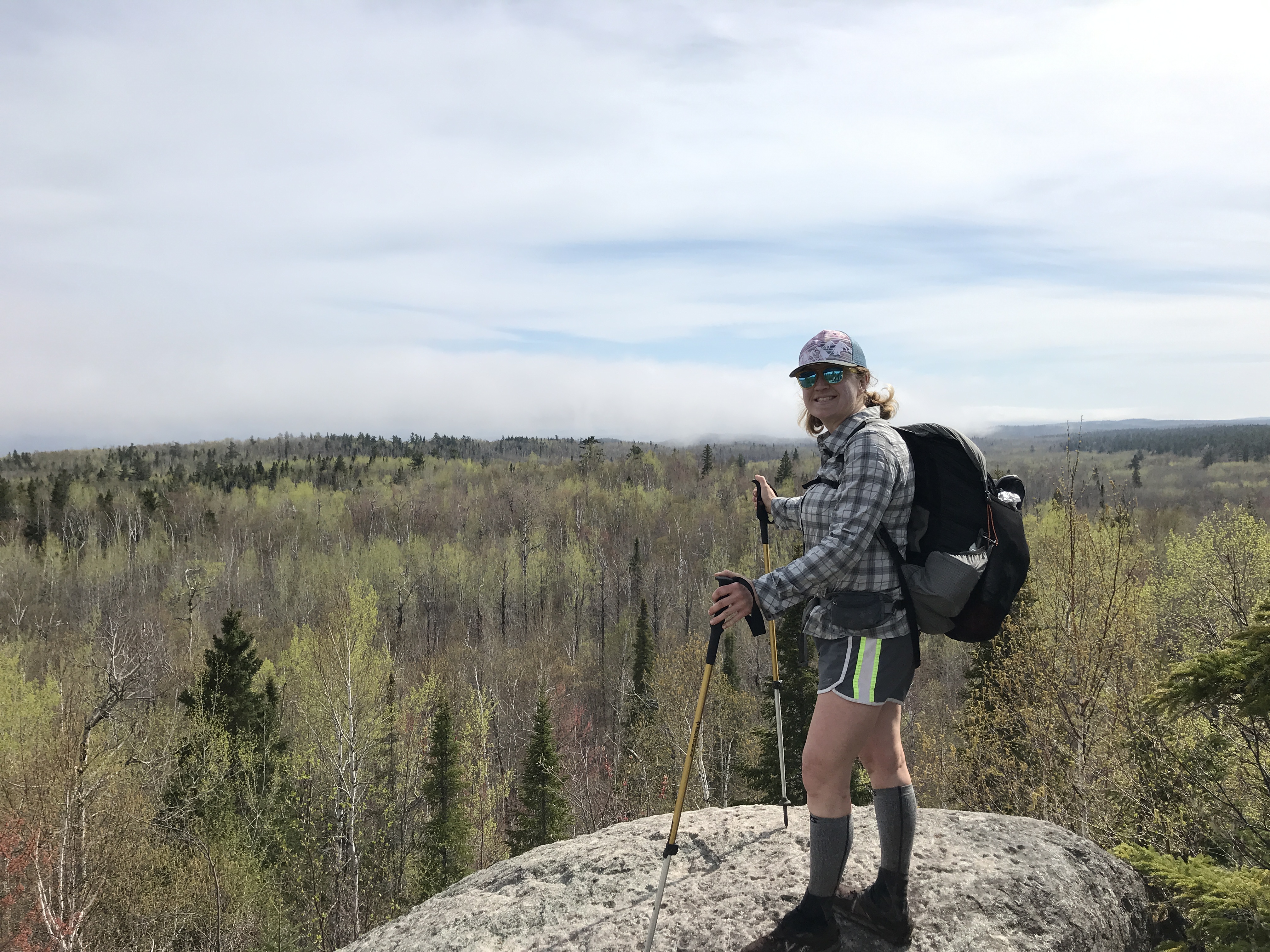 We rolled out of camp at around 8:30 and found more mud. Our climbs took us to overlooks of Silver Bay and Beaver Bay. The trees are just starting to show a tiny bit of green and the openness of the forest in the spring is a wonderful experience. It feels like we can see for miles!
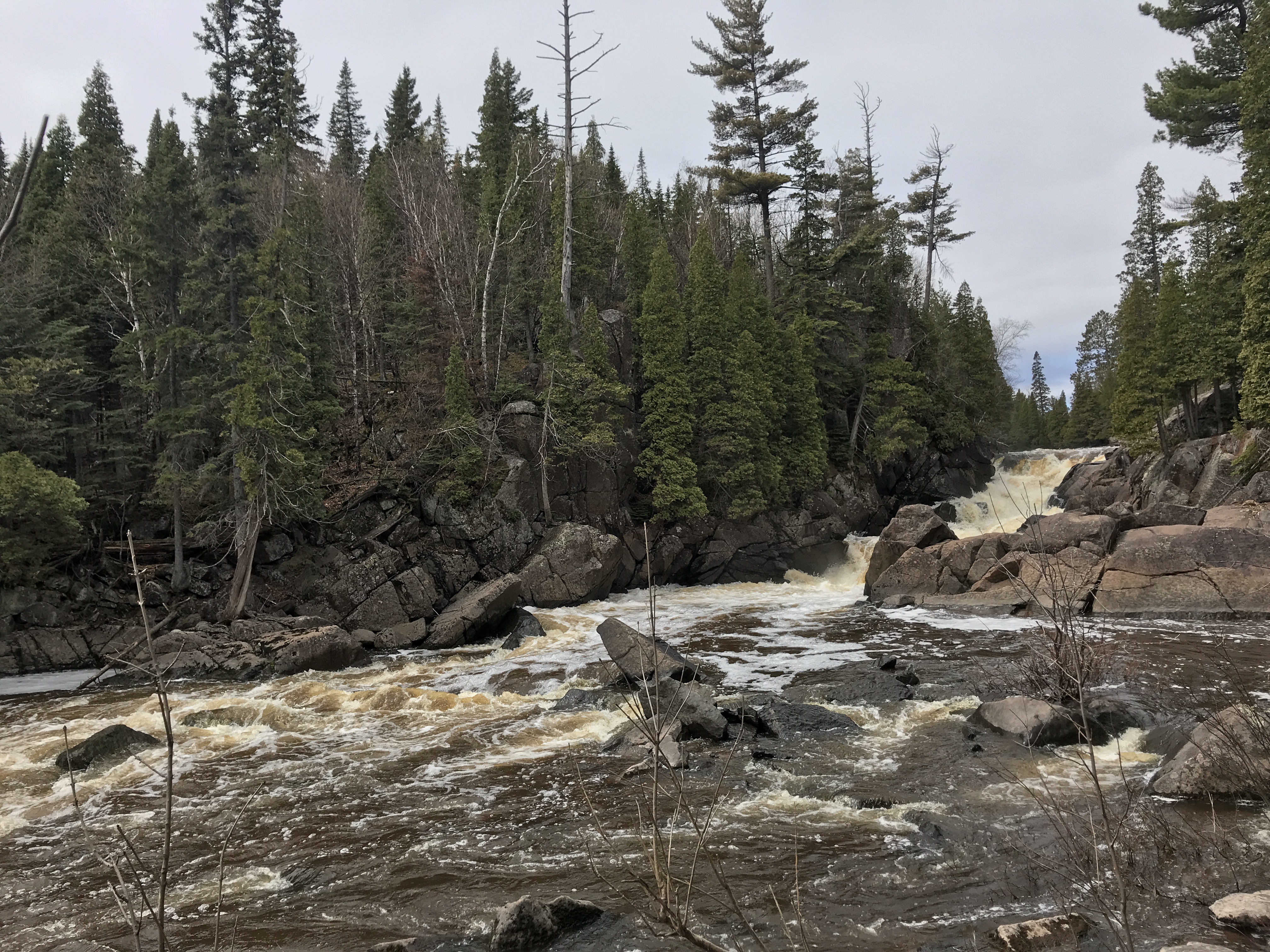 We stopped for lunch at the Beaver River Campsite. The river was roaring and spraying an icy mist that cooled us all off quick!
 I cleaned a bunch of foil out of the fire pit, aired out my feet and enjoyed a nice break.
Back on the trail, we passed several beaver dams and saw trees that had been chewed by the busy critters. The Beaver Pond campsite was totally flooded to the to the point that no one would be able to camp there. We walked on a nice plank bridge around the dam and arrived at Chapins Ridge, our camp for the night.
The campsite is on a big downhill slope in the Pines, so finding a spot was a little tricky. Once I had a spot, the roots made it tough to put the stakes in and get a good pitch, and I wanted to make sure that the solo Tarptent I borrowed wasn’t going to collapse in the night. I probably didn’t fuss with it that long, but after a long hike, it felt like it took forever to set up. After hanging up my wet gear, I went to work on trying to figure out how to stay warm for the night. It was supposed to get close to freezing with a midnight rainstorm.
 Around dinnertime, the temperature dropped quickly and we were all cold and ready for bed again. We hung our bear bags and stayed up long enough to see a weather forecast of cold temps and a full day of rain on our 5th day of the trip. We decided that after our group split, we’d push a few more miles and end the trip a day early.
 Time for bed! To stay warm, I wrapped my pad in my metallic emergency blanket, duct taping the sides together and borrowed an extra insulating layer from a campmate. I used my Enlightened Equipment snow wrap under my body, zipped up my jacket, pulled my hat down tight, and cinched my quilt tight around my pad with the straps.
Day 3: Chapins Ridge to West Gooseberry – 16.1 miles
I slept nice and warm, despite sounding like I was sleeping on a bag of potato chips and only woke up when the heavy rain hit. I cleaned out the fire pit (foil, trash, orange peels), made a quick breakfast and we hit the trail.


A few miles down the trail at the Split Rock Lighthouse Spur, we said goodbye to three of our “Blister Sisters” and the moved the van to our next trailhead. They were a great bunch to hike with and I hope we get to share the trail again soon!
 One last group photo and we’re back on the trail southbound, leading us through two road walks due to a re-route over private land access in the Gooseberry Falls area and a bridge that is still out over the Split Rock River.
 Hikers can do an out and back on both sides of the Split Rock River Loop, but this area had 10″ of snow last week, rain in between and is getting another blast of rain and snow as I write this post. We opted for the detour since we assumed that it would not be safe to cross with the heavy spring water flow.


We filtered water out of Lake Superior near the Split Rock backpacking site I stayed at last year and headed back onto the trail on the South side of the Split Rock Loop. A few miles ahead, we would hit the Gooseberry Re-Route.


This section was closed a couple of years ago due to hikers abusing the trail on a section that passes through private land. Its an inconvenience, but I don’t blame the land owners, and its a good reminder to follow Leave No Trace Principles and ONLY stay in designated campsites.
We enjoyed a little “civilization break” at the Gooseberry State Park visitor center. We cleaned up a little in the bathroom, filled our water bottles, fixed up our feet and headed back on the trail.
 The hike past the falls brought back so many fond memories of the park with my family and the Scouts, and it ended up being one of the most relaxing sections of the trip. Heading south of the park, the trail is flat and winds along the Gooseberry River, with wildflowers growing along the river and a forest floor carpeted with wild ramps (a type of wild onion).
We stopped at each of the Gooseberry sites and decided the last one, West Gooseberry would be our home for the night. I cleaned out the fire ring again, cigarette butts and a ratty Blink 182 T Shirt.
 The site was fairly small, but up high on an overlook, with a beautiful view of the Gooseberry River. Our 3 tents and 2 hammocks fit perfectly and we enjoyed knowing we were settling in here for the night.


We made a fire, hung our clothes to dry before the dew set in and cooked dinner. The first thing I always do when I get to camp is put up my shelter. After that, I feel like I can relax and enjoy the simplicity of simple camp chores, eating and going to bed.
 I prepared for a cold night again, apologizing in advance to my campmates for my loud “potato chip bag” sleeping mat and pulled out a chemical hand warmer just in case.
Day 4: West Gooseberry to Two Harbors- 13.7 miles
Slept cold again. In addition to my pad’s temperature rating, I suspect it may have to do with being by the water and the wind coming up through the sides of the Tarptent. I was only cold at Penn and Gooseberry, but stayed warm on a colder night, sheltered by more trees and on a floor of Pine duff on Chapins Ridge.


I drank a strong cup of coffee and hauled out by 7am. It was our coldest morning and we all hiked in our Puffy jackets for the mile or so. We warmed up just in time to climb Mike’s Rock, overlooking Lake Superior and Castle Danger.
 Shortly after descending, we hit the Castle Danger Parking lot where the 3 Blister Sisters left the van for us. Earlier that day, they sent us a message that they had run into hikers that said the Encampment River was thigh high. Considering how fast we had seen the other rivers and creeks running, we opted for the road walk detour instead of hiking a few miles to the River to only have to turn around and do the road walk anyway. Two of our group of 5 decided to skip the 6.8-mile road walk detour and bring the van to Two Harbors to meet us (God Bless ’em!). We took the opportunity to unload all but our ten essentials and day’s worth of food and slack pack the final 10 or so miles.
 We hopped onto the shoulder of Cty Road 3, waving back at local folks in cars, thankful it wasn’t a very busy road and making the best of these flat miles. The road walk was harder on my feet and joints than the trail for sure, but it was nice to pick up our pace. The mid day sun was blazing and I wished I had my umbrella.
After what felt like 10 miles, we finally tucked back onto the trail. The road walk was part of the experience, but not my favorite part of the trip. I was glad to be back in the ankle deep mud and thick of the forest. Our last couple of miles out, we encountered more blow downs and two creeks with bridges that had been washed out. Before we knew it, we were at the Two Harbors Trailhead!
 It was noon and we had completed the PURPLE MAP, which means I’m half-way done hiking the Superior Hiking Trail! Eeek!
 I found the most amazing pair of cheap gold Elvis Sunglasses hanging on the southbound sign, put them on, sang “Whoaaa, we’re half way therrrrrre!” (Bon Jovi) and decided that the Universe left them there just for this moment!
The other two Blister Sisters had been hiking a few miles on the South end of the trail and we happily reunited and grabbed our flip-flops out of the van!
 The highlight of the day was finishing our adventure at the Duluth Grill for a huge feast of everything from Cold Castle Danger Cream Ale with Fish Tacos to Onion Rings and Roasted Brussels Sprouts!
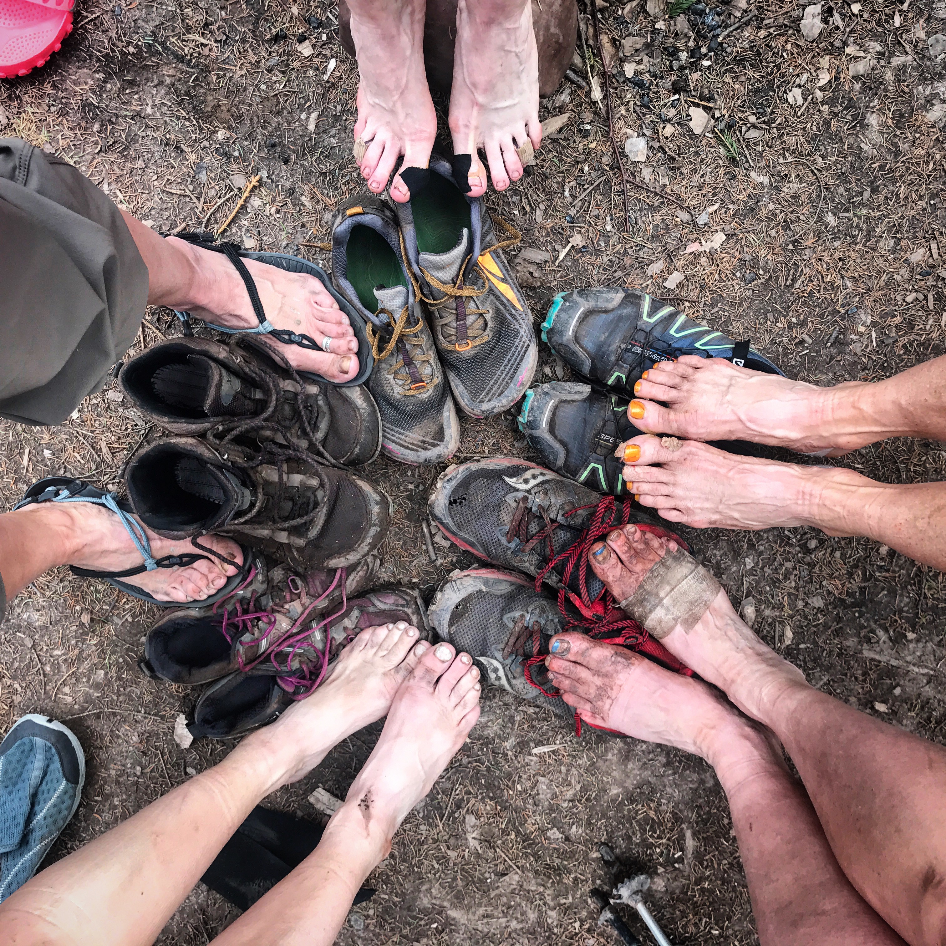
I was glad to be home a day early, feeling good, hanging with family…and having a extra day to clean and repack my gear for the next trip! I’ll enjoy hiking the Split Rock River Loop and Encampment river on day hikes in the future and can’t wait to hit the trail again after a little rest! Will we ever have clean feet again?
If you want to follow along on the final half of my SHT LASH, see my packing list, and read about what I’m learning along the way, hit subscribe and check out the Wandering Pine You Tube and Instagram for more!
Happy Trails,
~WP
Great story, but that weather didn’t sound very inviting! I have to admit that the ‘feast of everything from Cold Castle Danger Cream Ale with Fish Tacos to Onion Rings and Roasted Brussels Sprouts,’ did sound like a good way to end the adventure! I’ve ended many hikes up there meeting fellow hikers afterward at Northern Lights, in Beaver Bay… it became a habit for quite a few of us. Hope they’re open again…they had a fire. Half way there… liv’n on a prayer… the second half will be easy, given how early in the year it is… and the weather will be better as well! Congrats, that sounded like a pretty tough time given the water, mud, snow and cold weather! Hike on!
Thanks Mike! Looking forward to our upcoming trips! I love hearing your stories from the trail as well. I heard about Northern Lights, I hope they can open back up too. Prepared for more mud and more fun! Happy trails!
Great post! Glad to see you are able to continue on with your SHT adventures.
Thanks Linda! Hope we cross paths on the trail again!
Impressive mileage! And no blisters this time! What’s your secret?
SUPER excited about stairs at the drainpipe. The thought of doing it with a pack before the steps terrified me.
And great job cleaning up! (Not that I’d expect any less. 😊) Do you feel like it gets worse each year? We hauled a ton of crap out of our campsite last weekend … including batteries! Who leaves batteries laying on the ground? 🤦🏼♀️ I don’t know if it’s that more people are out and about or if people are becoming more careless. Either way, love how you’re setting the example and preaching LNT.
Can’t wait for the next hike. Stay warm!
Thanks Holly! We actually found very little trash on the trail, mostly micro stuff that people dropped accidentally or probably thought burned through. We did find some straight up litter, but not as much as I expected.
Regarding the feet, no blisters! Yay! I tried some new things from the book I read that I’ll probably go into in another post…but Wrightsocks socks, meticulously trimming and filing my toenails and calluses beforehand…and wearing shoes that fit were the biggies.
Thanks for reading and always being so encouraging!
Woot woot on the trash!
Great to hear on the wrightsocks. We both stocked up at REIs sale.
I can’t wait for the post! I’m currently trying to get rid of a callus I just discovered last weekend with little luck. Any quick tips?
Fun read. At 70 I got my pack out last year and did Castle Danger to Split Rock so I enjoyed reading your story. Any thoughts on N to S vs S to N hiking. Going solo with Ray, my blue tick coon hound. Enlightened is here in Winona!
Hi Fred! How exciting that you are hiking the trail with your pip! And Im a pretty big EE fan. I love that they are here in MN! I hiked Southbound because of the logistics getting to the Northern Terminus and I liked the idea of hiking towards home instead of away from it. People do both, and you certainly wont avoid any elevation either way. Take your time and enjoy every step! Happy trails!