
Wandering Pine is reader-supported. When you buy through our links, we may earn an affiliate commission at no additional cost to you. Thank you! Learn more.
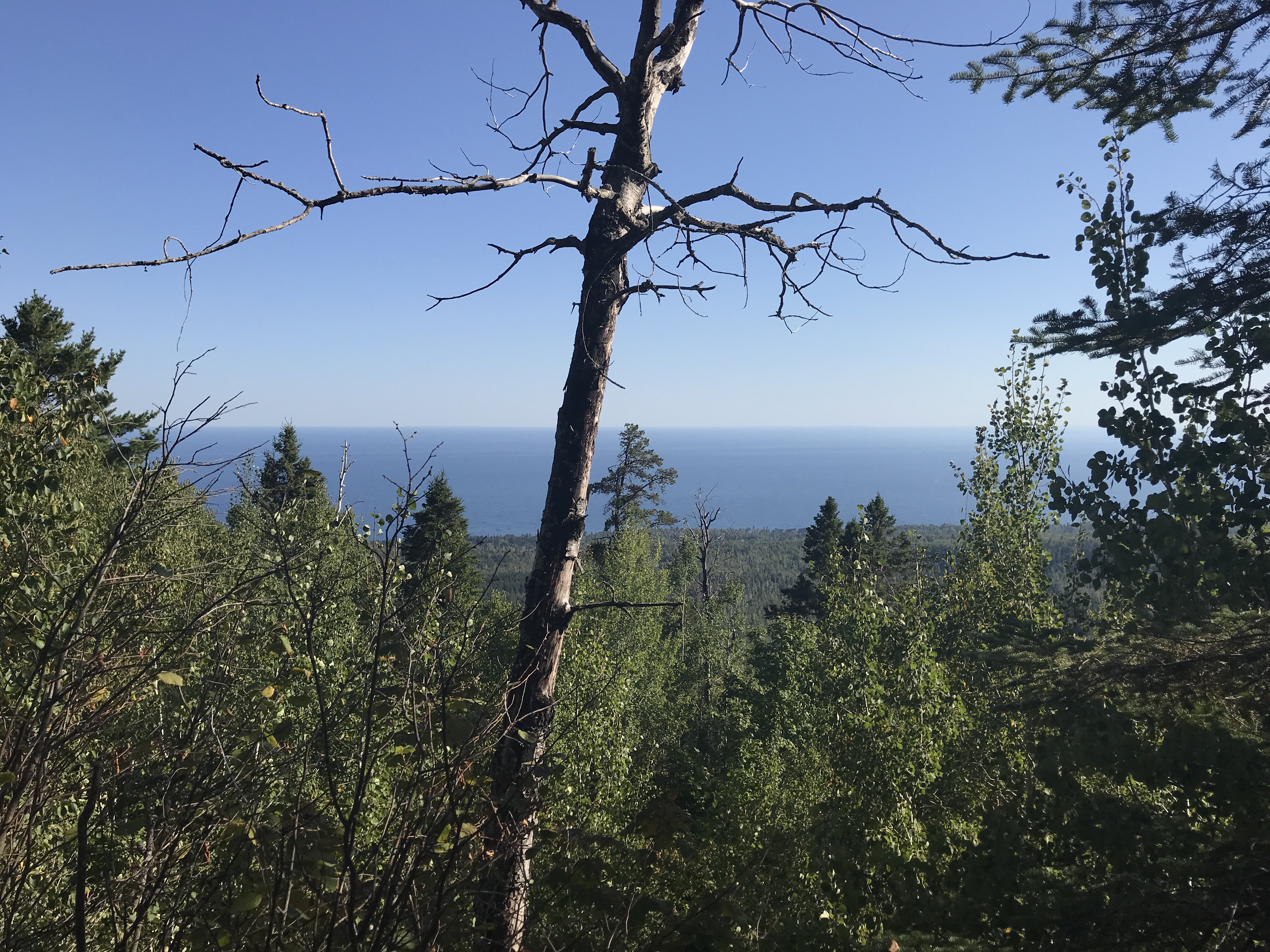
The Trail is characterized by ascents to rock outcroppings and cliffs, and descents into numerous river and creek valleys. Most rivers and streams are crossed by bridges. Overlooks of Lake Superior, the Sawtooth Mountains and inland woodlands, lakes and rivers are abundant. The Trail follows rivers and creeks, often for distances of a mile or more, showcasing waterfalls and rapids, bends and deep gorges where thousands of years of rushing water has cut into layers of ancient volcanic rock.
One of the more challenging aspects of hiking the Trail is the elevation changes. Instead of long climbs and descents found in mountains, the SHT is constantly ascending and descending.
At its lowest point, the Trail goes along the lakeshore, which is 602 feet above sea level.
At its highest point the Trail is 1829 feet above sea level and more than 1000 feet above Lake Superior. reference
 This morning we woke up early after having the Mystery Mountain Campsite all to ourselves. We tried to hang some of our damp clothes inside the tent expecting rain, but it never came…and they never dried. We put on wet clothes every morning and wear them dry. The forest is damp and the days are cool and humid up here. Fall is in the air!
 This is the first time we haven’t camped with anyone else and it made a big difference in the time we went to bed and the ability to get going in the morning. My legs and feet feel much better after making myself lay down at around 7 PM and being off of them for almost 12 hours! We really enjoy camping with others, but being alone allowed us to get some needed rest, and haul out of camp by 7:10!
We have a big day planned today, 20 miles over one of the toughest sections of the trail. It’s ambitious, but we know where we can cut it short if we need to. I realize hiking 20 miles over 6 mountains is probably a bit much but had done this section before with the Ultimate Hike CureSearch Team and know we can do it. I thought of Dad every time a red squirrel visited us today. I think he’d be be proud of us for embarking on this crazy walk.
In one 20 mile hike, we gained at least 1,660 ft and decended 2,210 ft. That’s nothing to shake a stick at! We avoided the spur trail overlooks but still got some sweet views from the sawtooths!
- Mystery Mountain
- Moose Mountain
- Oberg Mountain
- Leveaux Mountain
- Britton Peak
- Carlton Peak
 Water is either .5 miles North at Poplar River or about 5 miles South at Rollins Creek from Mystery Mountain Campsite. We started with full water bottles and decided to blast Mystery and Moose Mountains, then stop for breakfast on the bridge over our first water stop. We snacked along the way and made it to Rollins Creek by 9am! The water filter bladder contraption I made started leaking on the clean connection today. I lost the O ring somewhere but it still did a great job filtering and the large opening made filling it much easier than my Sawyer Squeeze bag!
 Bear wasn’t feeling too great at our water stop and her appetite was down, but she still always manages to blaze the trail and lead the pace. Her knee and quad are really bugging her today. She put on the knee support I picked up in Grand Marais, hoping that would help. We talked about how far we should hike and made a plan to stop at Springview Creek Campsite if 20 was too much. My appetite, on the other hand went into high gear and I ate almost everything I had in my big food bag before lunch time! I keep my pockets full of food and try to eat something at least every hour. I can still feel the blisters on my feet, but I think they’ve stabilized and I’ve got my hiking legs. I feel so much better than I did a couple of days ago. I feel bad for Bear today.
 Uffdah! About 2L of water in already…and sweating like crazy. Two mountains down, 4 to go!
 Time to switch maps!
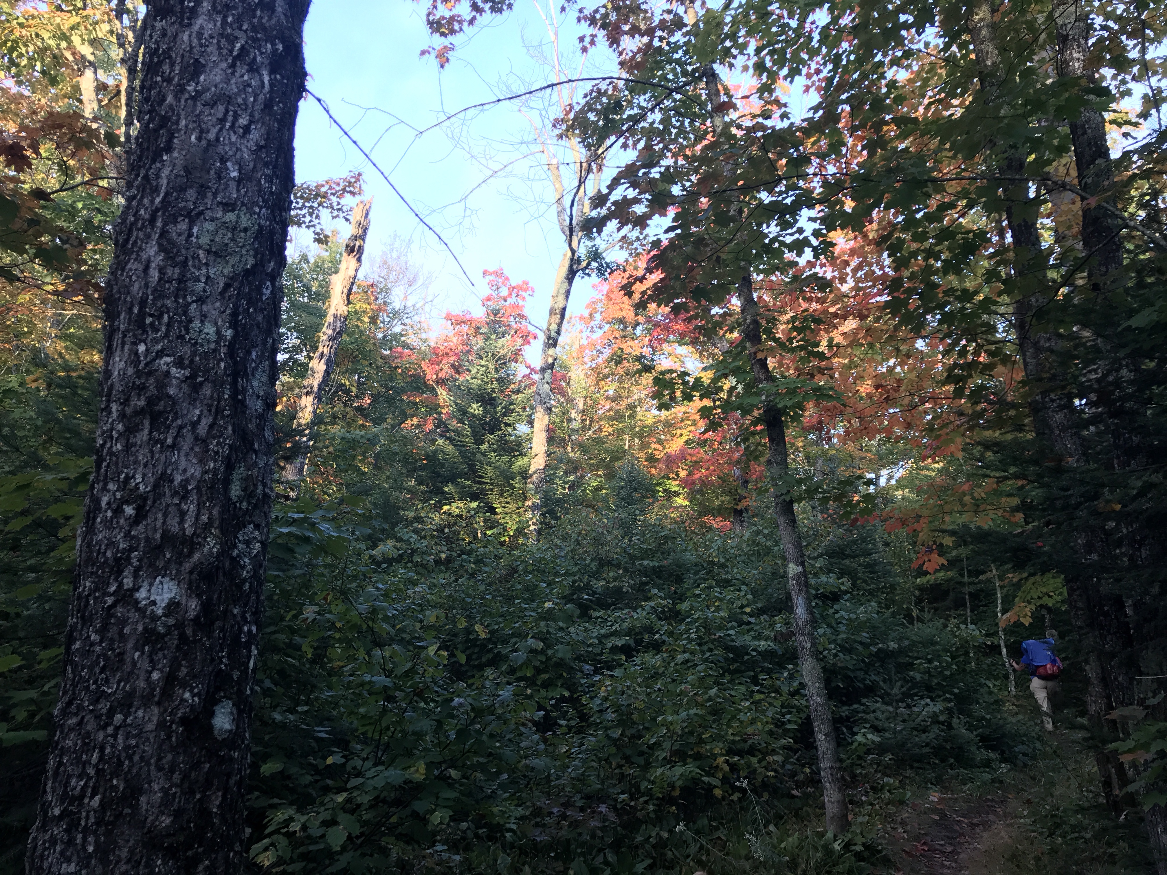
At around 10:30, right after Oberg, we stopped for a little break at the Onion River Campsite. It was the only site we’ve seen that’s nestled in a pure Pine Tree Grove. It smelled like heaven and the sun filtering through the trees was a welcome change from the clouds and damp dark canopy of the forest. It had long benches and a PICNIC TABLE! Its funny how a little luxury like these were such a highlight.
 Bear was feeling sore and exhausted at this point and took a long nap. We stayed here for 2 hours, resting, eating, hydrating, drying out clothes in the sun and recalibrating. We didn’t feel any pressure to be anywhere and it’s nice to have places to stop along the way, like this.
We grabbed more water at Onion River and headed towards the Leaveaux Loop and Britton Peak. A group of day hikers asked us for directions and I’m afraid that I was so discombobulated that I may have led them the wrong way. I hope they figured it out! Oops, sorry guys.

Next up: Britton Peak! We would decide along the way if Carlton Peak was in the plan based on how we felt at Springview. Bonus: I discovered that my compression sleeves still fit hiked up over my knees and worked like knee support for the long decents. High fashion right there.

Its pretty tough to get lost on the SHT. Blue Blazes and signs abound. We did get turned around a couple of times earlier on the trek, but admit that we really weren’t paying attention both of those times. Its pretty amazing how, even in the most remote sections, the trail is clearly marked and easy to follow. Our only complaint was that we never could seem to accurately estimate our miles between destinations. We used a few different resources, but because of the change in terrain and winding routes, sometimes a mile would feel like 3 miles…

We stopped for a break and to have a discussion about the rest of the day’s plans at Springview Campsite. This was the last campsite for 6-7 miles and wanted to either park it or push on to Temperance. On the walk up to camp, we saw a guy! I hollered “HELLO!” to let him know we were coming and immediately recognized him! This is Kevin, my friend, Roxanne’s husband. He is planning on hiking 96 miles 3 days! WOOF! He was on a quick break, told us trail conditions to Temperance and got back on the trail quickly. He encouraged us and it was nice of him to stop and chat for a minute. We were pretty impressed with his ambitious goal!
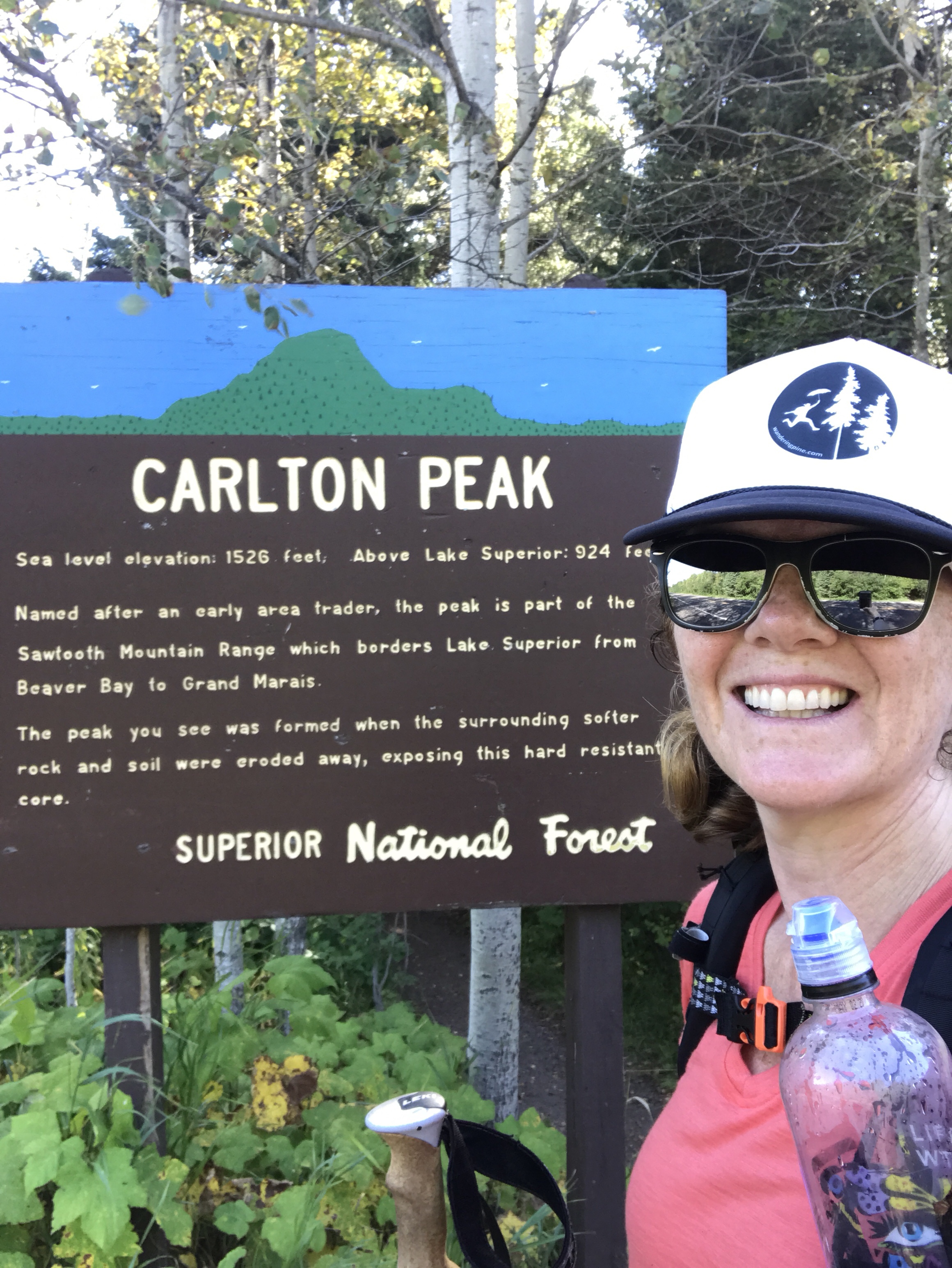 Since it was 3:30, we decided we had 6 or 7 miles left in us and headed towards Carlton Peak and Temperance River State Park with the promise of a hot shower!
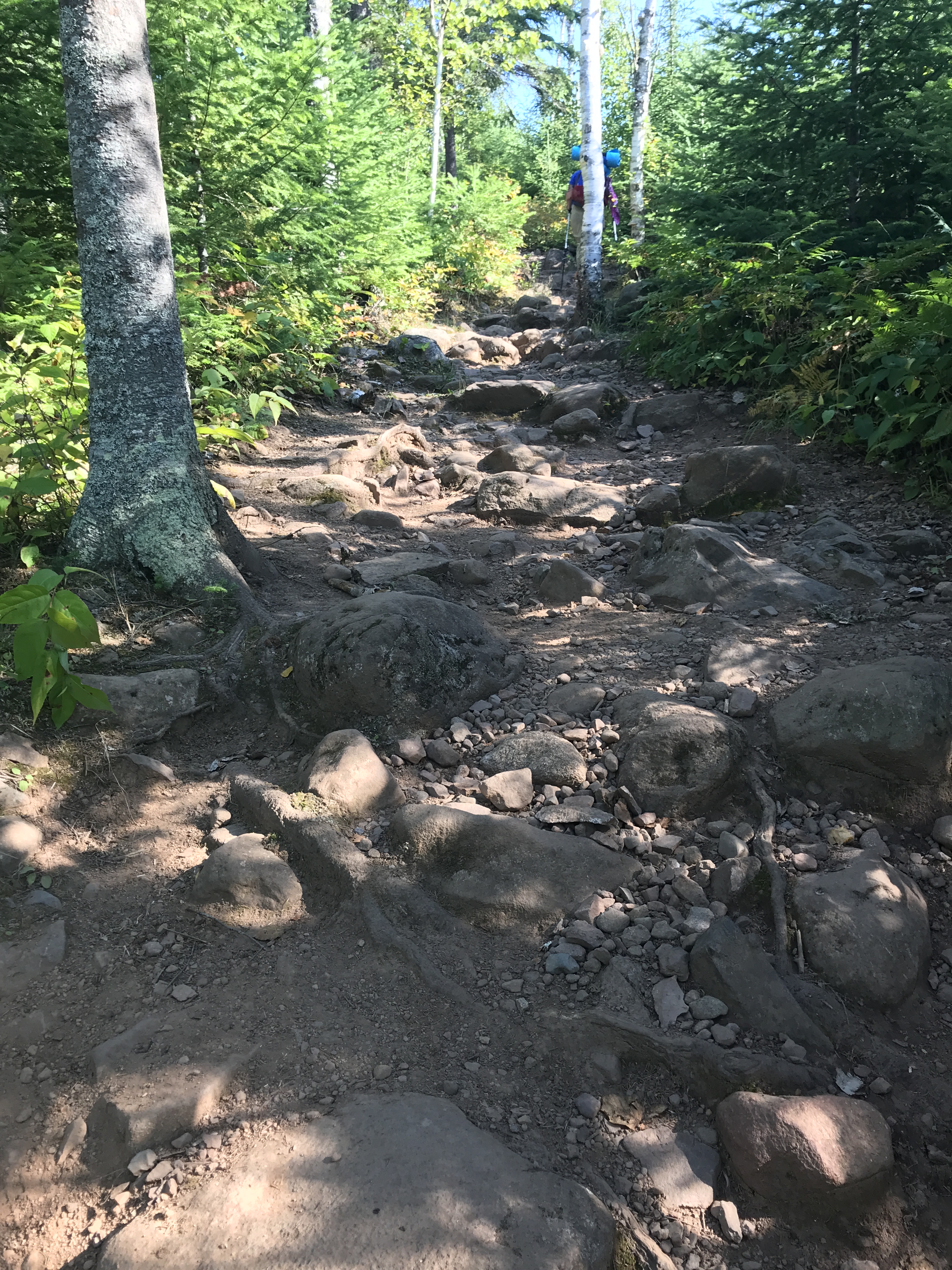
The hike up to Carlton Peak is no joke. 400 feet up and 800 feet down after a day of already tromping 1,260 feet up and 1,410 feet down. The terrain is steep, rocky and requires concentration. We decided to pass on the summit because we were starting to get tired.
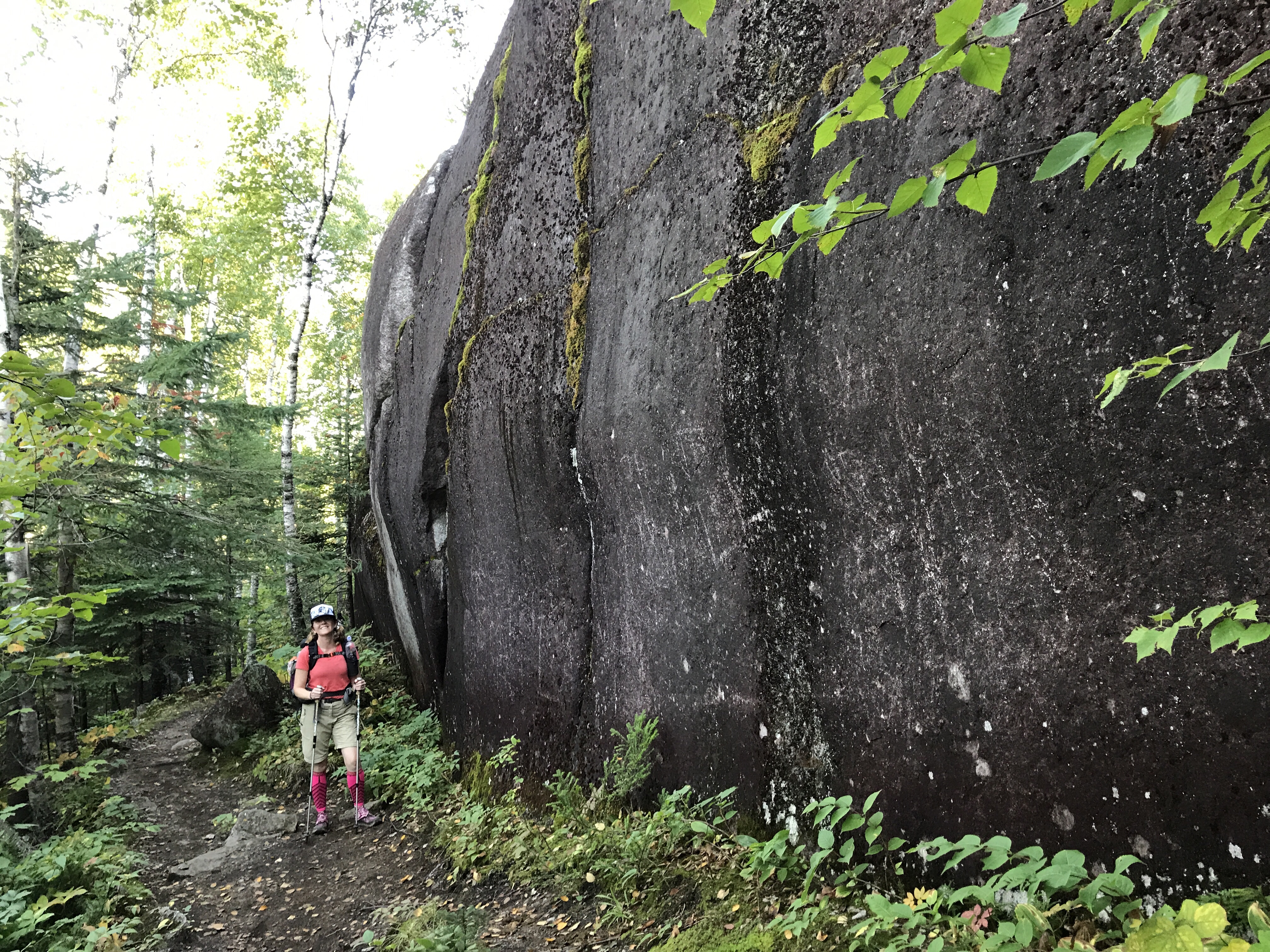
 There were several overlooks of Lake Superior on this section and we met a couple of really nice rock climbers on the way down. Meet Matthew and Layla Awesomesauce from Spirit Guiding Adventures!
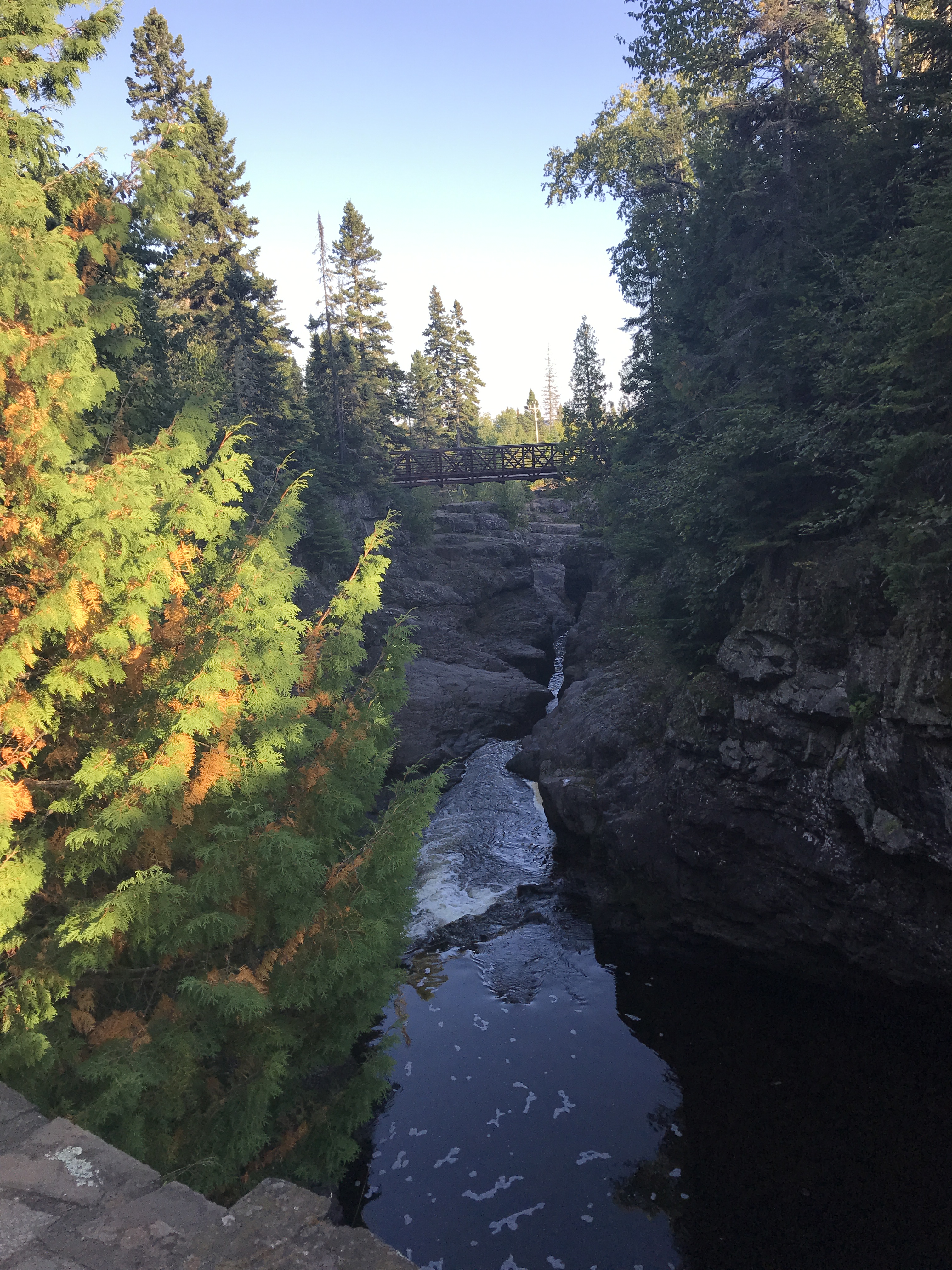
 We are in the home stretch! We can hear the Temperance River roaring in the distance…and that can mean only one thing… WE ARE ALMOST AT CAMP AND A HOT SHOWER!
We made it! We practically skipped the last mile to the Park entrance across Hwy 61 and got to the office just before 6PM. We snagged THE LAST CAMPSITE and happily paid $30 or an electric site that was among all of the big motorhomes. We felt triumphant as we walked into camp and set up our little tent on the big RV site. Bear crashed on the picnic table and I immediately headed for the shower! We did it! We are so proud of ourselves and our accomplishments today! It was tough, but we did it!
 Wandering Pine (aka Red Squirrel) and Bear (aka Hornet Bait)
…aka the Undefeated Pine Sisters.
Trail Log:
Amazing adventure! You two are tough as nails! Congrats on 100 miles.I can’t wait to see you on your next adventure! 🙂
Thanks Karen!
Gotta love the Temperance River gourge… beautiful!